
Grampians National Park is part of the Gariwerd Aboriginal cultural landscape. Parks Victoria respects the deep and continuing connection that Traditional Owners have to these lands and waters, and we recognise their ongoing role in caring for Country.
![]()
![]()
![]()
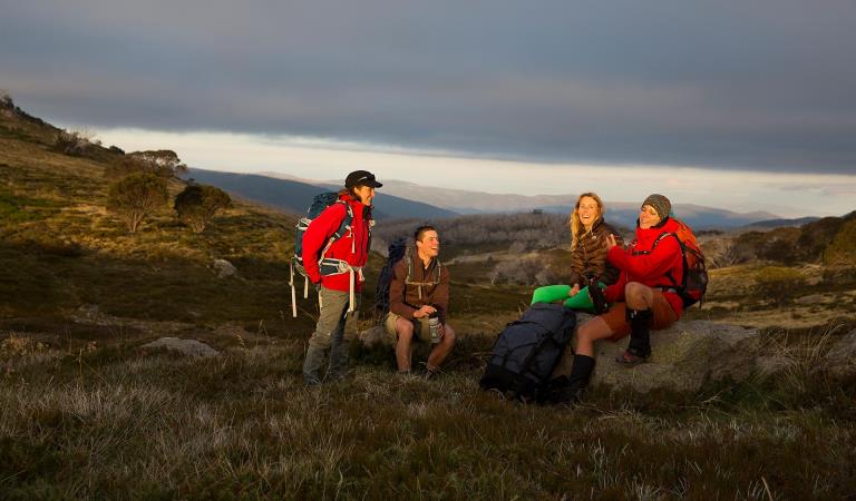
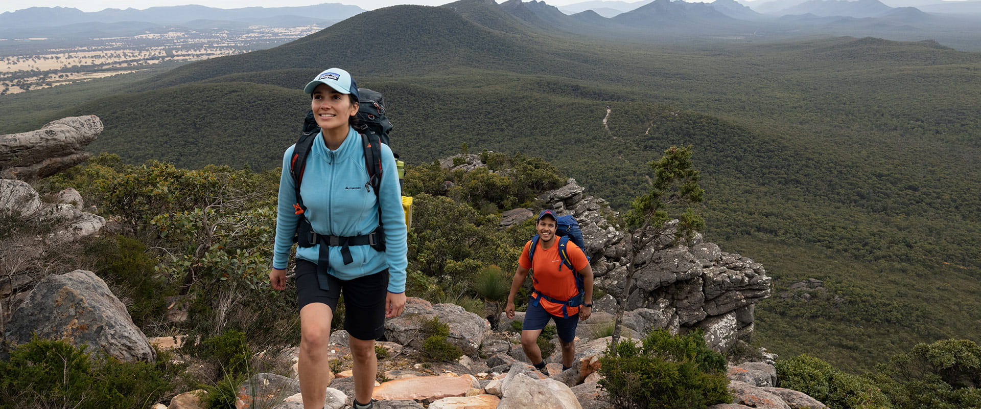
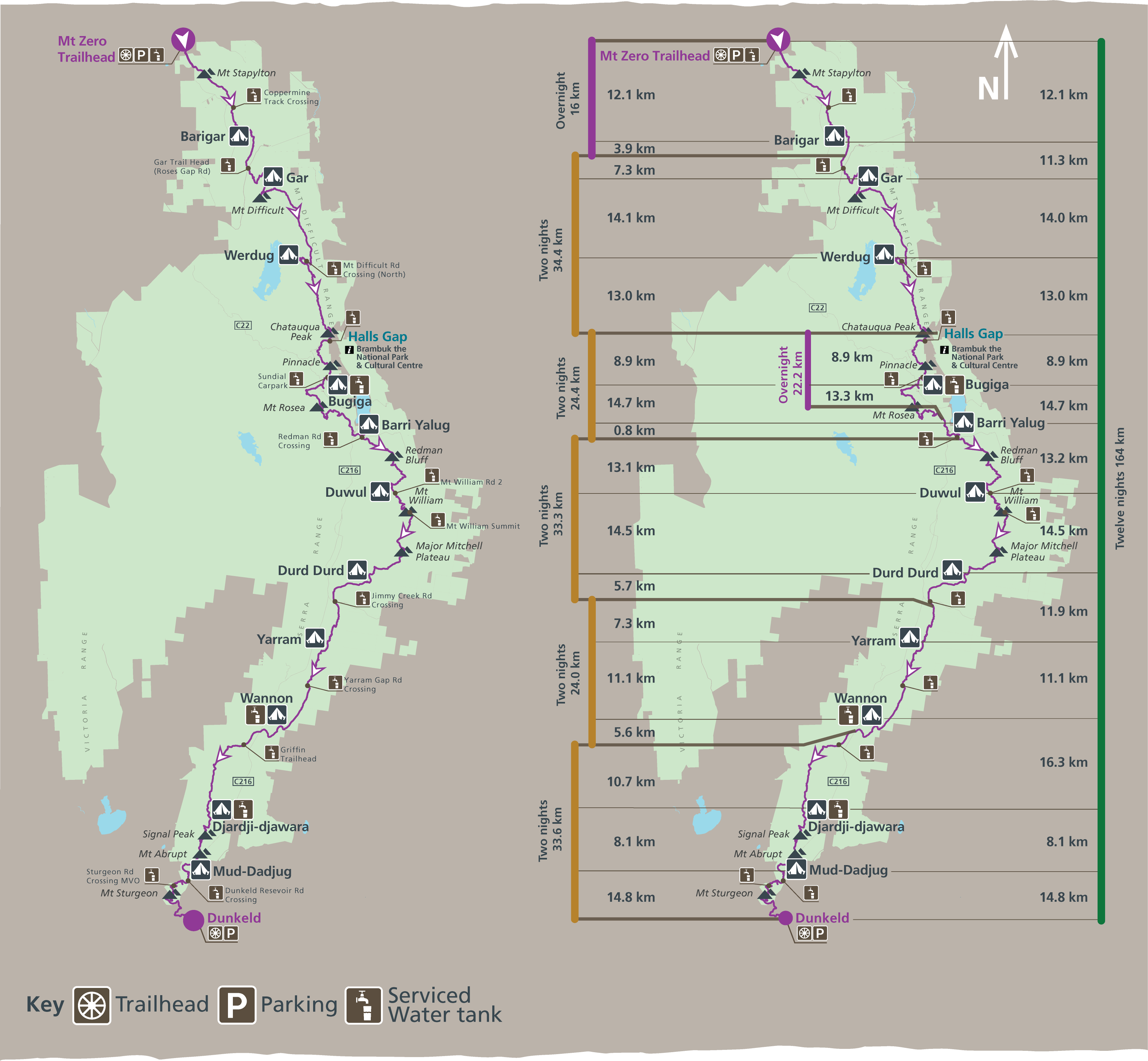
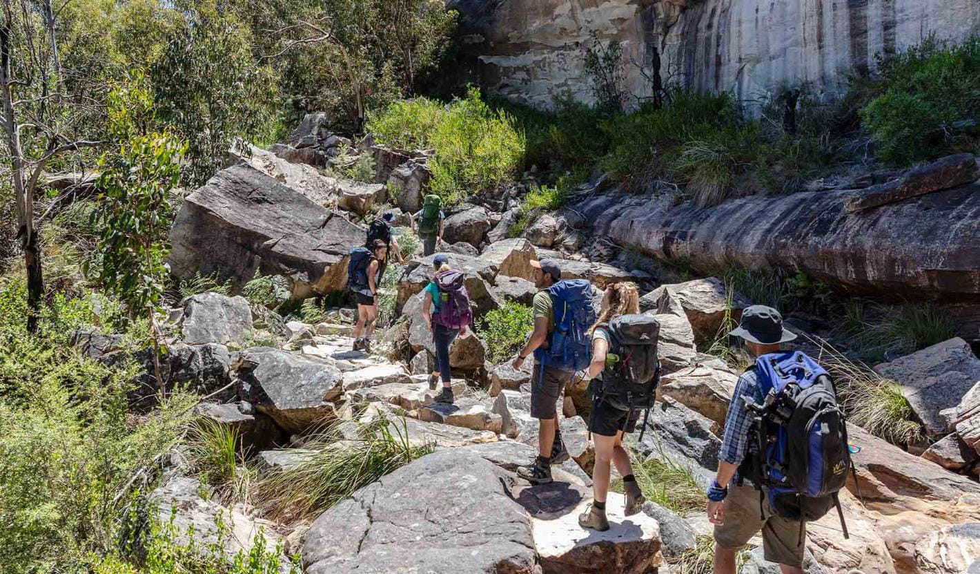
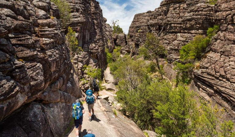
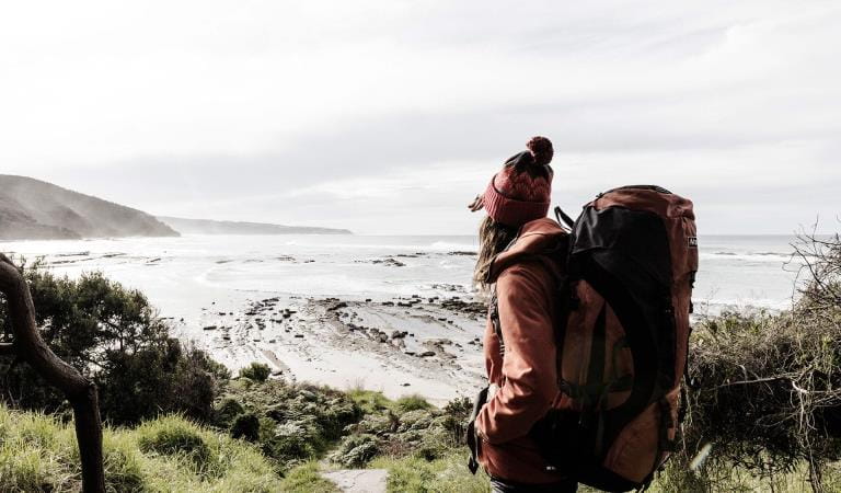
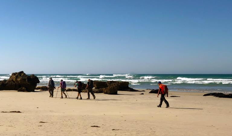
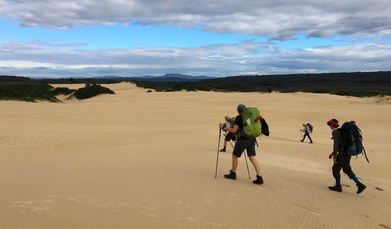
The spectacular Grampians Peaks Trail (164km) is a challenging 13-day/12-night hiking experience through a variety of terrain in the Grampians (Gariwerd) National Park. Starting at Mt Zero in the north and heading south, the trail passes over the summit of Gar (Mt Difficult), continues through Halls Gap with hiking highlights including Redman Bluff, Mount William, Major Mitchell Plateau, Signal Peak, Mt Abrupt, Mt Sturgeon (and more) before reaching Dunkeld in the south.
Stay at unique hike-in campgrounds along the trail, climb dramatic mountain peaks with panoramic views and hike along rugged rocky ridgelines. Experience a rich diversity of plants and animals and the ancient Aboriginal culture of Gariwerd. The trail caters for a variety of hiking styles, from self-guided walkers and groups to school groups and fully-facilitated hikes with a Licensed Tour Operator.
New changes to booking system
We have made changes to the Grampians Peaks Trail booking system making it easier to book and with more flexibility in how you plan your hike. Find out more.
 Plan and prepare
Whether going for a day walk, multi-day hike or the full 13-day experience, start planning your Grampians Peaks Trail adventure and download the Grampians Peaks Trail Plan and Prepare Guide.
 Book
Book
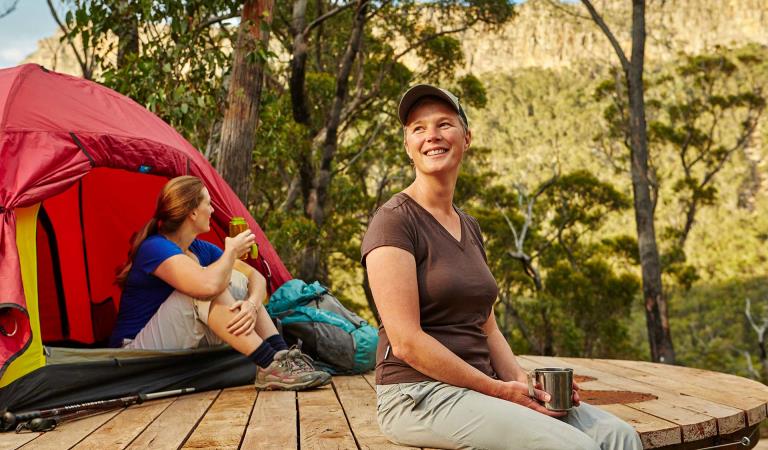
Book on-trail hike-in campgrounds before you start a multi-day hike (camping fees apply). See Visit Grampians for off-trail accommodation, tours and transport options. Bookings are now open to 6 October 2024.
 Get packing
Pack your gear and equipment, food and water. Include maps and safety devices. See the handy packing list in the Grampians Peaks Trail Plan and Prepare Guide.
 Set off and stay safe
Set off on your Grampians Peaks Trail adventure only when know how to walk it safely. Read the safety and emergency information, and check for any last minute changes of conditions. You can also call into Brambuk the National Park and Cultural Centre in Halls Gap and speak to knowledgeable staff for the latest park information.
 Care for Country
Minimise your environmental impact when completing the Grampians Peaks Trail. Take out what you take in – leave no rubbish behind. Stay on the trail, leave pets, drones and loud music at home. Campfires are not permitted.
 Share
Share
Share photos and videos of your Grampians Peaks Trail adventure on social media and inspire others to do it. #grampianspeakstrail
Choose your journey
Grampians Peaks Trail
Bookings are now open to 6 October 2024. Choose an option below and find out more.
Book Grampians Peaks Trail your way
We've opened up flexibility in how you choose to hike GPT. Plan your itinerary, then use the interactive map to book your hike.
Choose your own adventure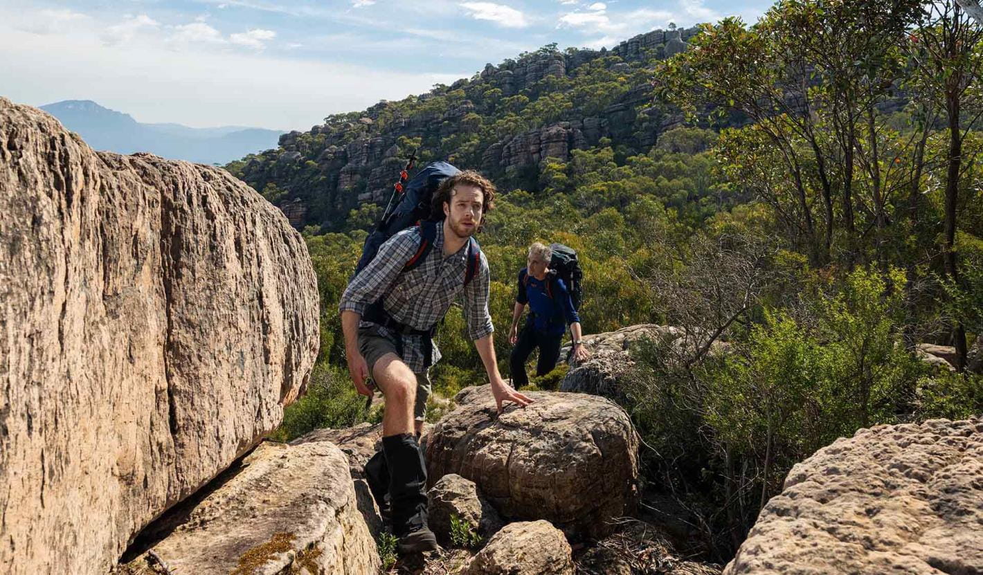
Full Grampians Peaks Trail (north to south)
If you’re bold and committed to completing this 13-day/12-night hike, you will have an unforgettable adventure and be rewarded with some of the best hiking trails and panoramic views in Australia.
Explore the full trail experience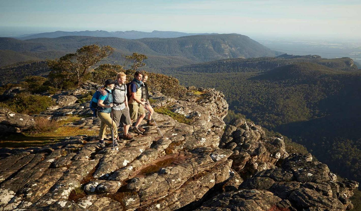
Northern Peaks Experience (Huts)
The Grampians Peaks Trail provides hikers with the option of staying in eco-friendly hiker huts on the Northern Peaks’ (Gar and Werdug) two-night itinerary.
Experience the Northern Peaks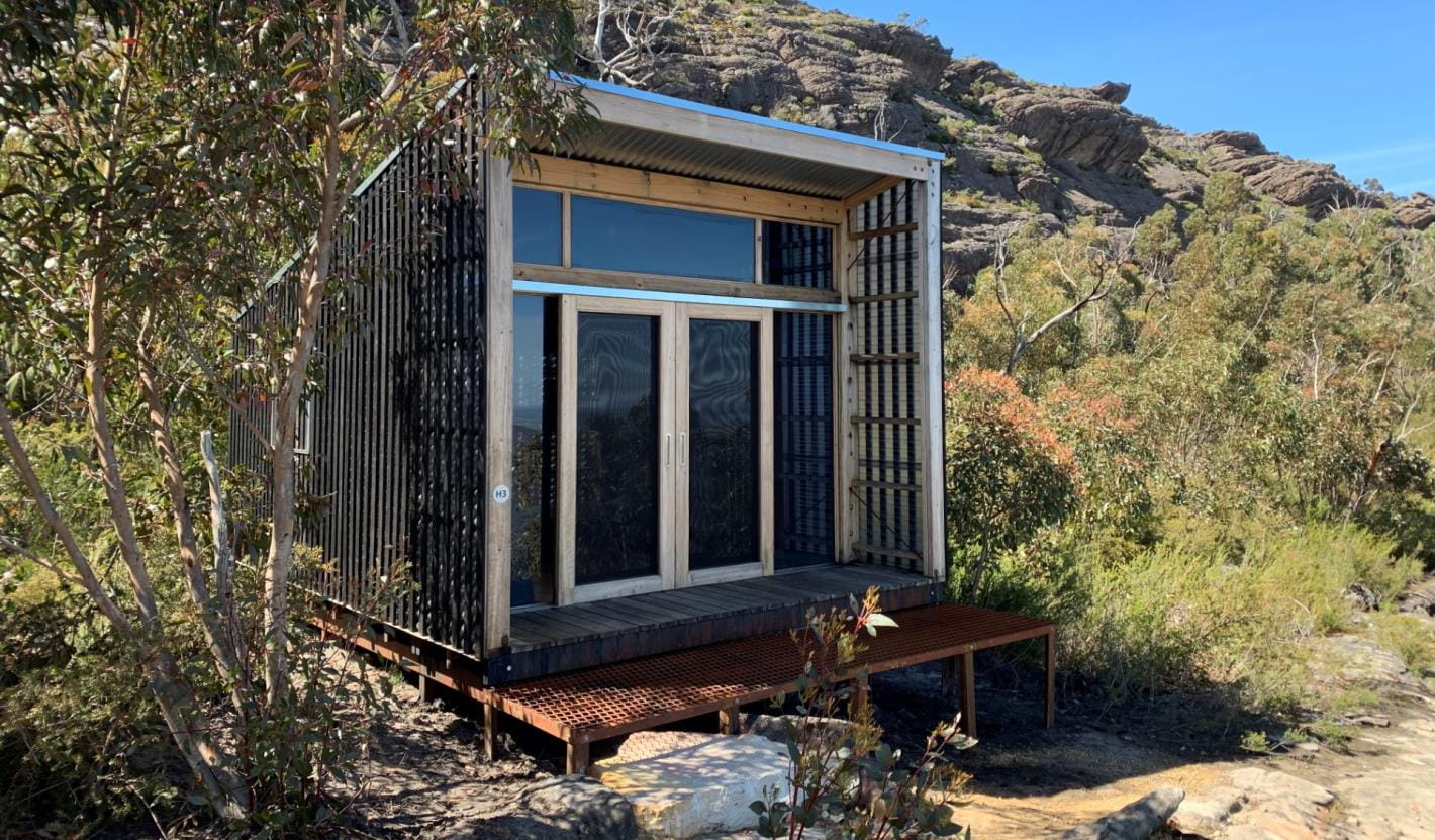
Multi-day hikes (3 days or more)
For people who enjoy an outdoor adventure but don’t have time to do the full 13-day Grampians Peaks Trail, breaking it up into smaller 3-day hikes is a great way to challenge yourself, build-up long distance hiking skills and experience the spectacular living cultural landscape of Gariwerd. Return again at your leisure to complete more sections of the trail. You can also add individual overnight and 3-day hike itineraries together to create your preferred hiking adventure.
Explore multi-day hikes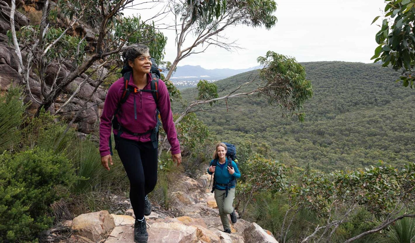
Overnight hikes
Choose from three different 2-day hikes available and explore the trail that little bit further.
Explore overnight hikes
Day walks
Day walks are a great way to try smaller sections of the trail. Choose from some of our favourites in northern, central and southern Grampians.
Explore day walks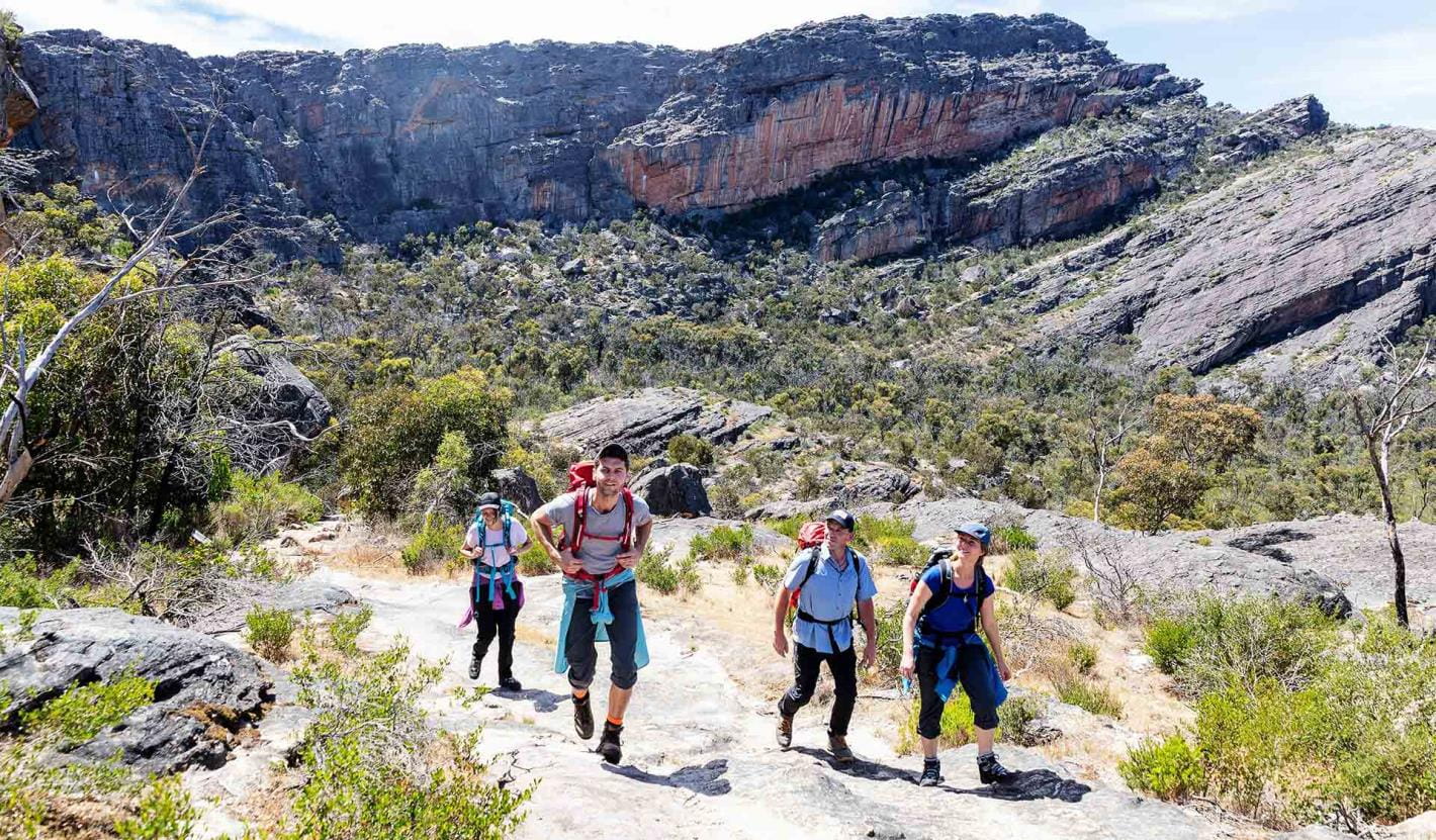
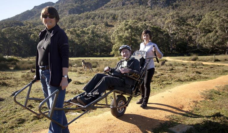
School and independent groups
Schools including clubs and independent groups, wishing to undertake the Grampians Peaks Trail have the option of walking and camping on trail or camping off trail in designated group camps or private accommodation nearby.
To walk and camp on trail, group sizes are up to 16 people, depending on site availability.
Experience with a Licensed Tour Operator
One of the best ways to experience the Grampians Peaks Trail is with a Licensed Tour Operator. Whether you're looking for a fully guided experiences or just support services, here you'll find a Licensed Tour Operator that assist you.
Go with a Licensed Tour Operator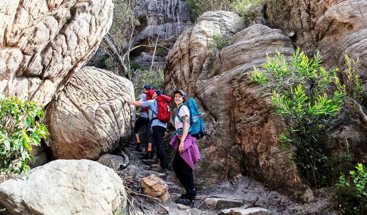
Enhance your experience
Grampians Peaks Trail
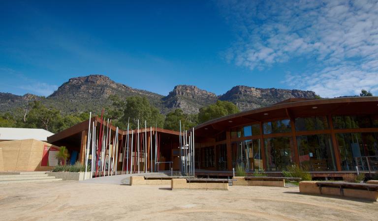
Brambuk The National Park and Cultural Centre
Explore the region
Prepare for your adventure
Grampians Peaks Trail
Water safety
Plan and prepare
7 Things You Need To Know About Hiking the Grampians Peaks Trail
Laura Waters, long distance hiker and author, was one of the first hikers on the trail, setting out on the first day of the GPT opening.
More information about Grampians Peaks Trail
GPT topographic maps
Visit Brambuk - The National Park and Cultural Centre in Halls Gap for topographic maps and speak to knowledgeable staff for the latest park information.
You can also order Grampians Peaks Trail topographic maps over the phone from Brambuk, call 8427 2058 (open 9am-5pm daily; except Christmas Day).
Hike the Grampians Peaks Trail with Caro Ryan
These videos, in partnership with Caro Ryan from LotsaFreshAir, show you the terrain, what to expect and include helpful tips on how to prepare for this challenging Grade 4 hike. Join Caro on her experience below.
Grampians Peaks Trail - North Section
Grampians Peaks Trail - Central Section
Grampians Peaks Trail - South Section
How to prepare your fitness and body for the Grampians Peaks Trail
Grampians Peaks Trail Logistics and Planning
Grampians Peaks Trail - Everything you Need to Pack Explained in 5 Categories
How to get there
The Grampians Peaks Trail runs from the northern point of the Grampians National Park (near Dadswells Bridge) to the southern point of the park (at Dunkeld). It is located in Western Victoria, a three-hour (260km) drive from Melbourne and a five-hour (460km) drive from Adelaide. The central Grampians is easily accessed from the villages of Halls Gap and Wartook and is a scenic day trip from the regional towns of Hamilton, Horsham, Stawell and Ararat. It is also a key destination on the internationally renowned Great Southern Touring Route.
Change of Conditions
Nature being nature, sometimes conditions can change at short notice. It’s a good idea to check this page ahead of your visit for any updates.
-
Notices Affecting Multiple Sites
Temporary Closure Notification – Planned Burn – Cassidy Gap
FFMVIC have scheduled ignition for the following Planned Burn within Grampians (Gariwerd) National Park.Cassidy Gap (GR-WIM-CAV-00071)This burn is located 3km north of Dunkeld and includes section S3 of the Grampians Peaks Trail.Start Date: Thursday May 2ndEnd Date: Thursday May 9thIgnition is scheduled from Thursday May 2ndFor visitor safety and to allow FFMVIC staff to prepare and deliver the burn, temporary closures along the Grampians Peaks Trail and day walks will be in place. These will re-open when the burn, or specific areas of the burn are declared safe.Closures from 5:00pm Wednesday May 1st until at least Friday May 3rd, 2024· Grampians Peaks Trail (Section S3) north and south bound hiking between Cassidy Gap Rd Trailhead, over Signal Peak to Dunkeld Reservoir Road.· Mud-Dadjug Hike-in Campground.· Mt Abrupt carpark and walking track closed.· Signal Peak walking track closed.· Mann’s Road is closed east of the intersection with Victoria Valley Rd· Serra Range Fireline is closed at the intersection of Vic Valley Road and Cassidy Gap Road· Cassidy Gap Road from closed from its intersection with Serra Range Fireline to its intersection with Grampians Rd.Closure signage will be in place at roads, trailheads, and car parks. Please follow directions and do not enter closed areas.Visitor access remains open to:· Djardji-Djawara Hike in Campground will remain open, though depending on conditions, smoke may impact the area.· Piccaninny (Bainggug) day walk from Victoria Valley Trailhead and Piccaninny Carpark· Mt Sturgeon (Wurgarri) from Mt Sturgeon Carpark and DunkeldHow will this burn impact my Grampians Peaks Trail experience?There are no walking track detours around the burn unit and closures along section S3 of Grampians Peaks Trail (Cassidy Gap to Piccaninny). This means a change to your GPT itinerary.There are multiple ways to re-plan your visit and Parks Victoria staff will help you to work through the best option. Please contact Brambuk the National Park and Cultural Centre – Ph 8427 2058 for further assistance with managing this section. Stay informed about this Autumns planned burns schedule:Visit & Sign Up: Sign up to Planned Burns Victoria www.vic.gov.au/plannedburns Set up automated notifications about upcoming planned burns on public land near you. There is no charge to sign up to receive text messages.Download: The Vic Emergency App. Set up a watch zone and choose to be notified about planned burns in the ‘alerts’ settingsCall: The Vic Emergency Hotline on 1800 226 226 and request an interpreter or assistance for hearing difficulties via the National Relay Service. IN AN EMERGENCY CALL 000Email: For specialist advice about planned burns in the Wimmera District you can contact Horsham FFMVic Office at wimmera.fuelmanagement@delwp.vic.gov.au or phone the office on (03) 8508 1222.For Information about park closures and campground bookings within Grampians (Gariwerd) National Park:Visit the Parks Victoria website: https://www.parks.vic.gov.au/places-to-see/parks/grampians-national-park#change-of-conditionsVisit: Brambuk the National Park and Cultural Centre – 277 Grampians Road Halls Gap, Ph 8427 2058 or for bookings and cancellations advice contact the Parks Victoria Information Centre Ph 13 1963 or email info@parks.vic.gov.auYou may see or smell smoke in the vicinity of the burn. For advice on how this may impact your health, visit www.epa.vic.gov.au/smoke
Temporary Closure Notification – Planned Burn – Jimmy Creek Rd
Temporary Closure Notification – Planned Burn – Jimmy Creek Rd
FFMVIC have scheduled ignition for the following Planned Burn within Grampians (Gariwerd) National Park.
Jimmy Creek Road (GR-WIM-HG-0103)
This burn is located, this burn is located in the south-east area of Grampians National Park, 8km E of Mirranatwa, 37km north of Dunkeld.
Start Date: Wednesday 1st May 2024
End Date: Wednesday 8th May 2024
Ignition is scheduled from Wednesday May 1st
For visitor safety and to allow FFMVIC staff to prepare and deliver the burn, temporary closures along the Grampians Peaks Trail and day walks will be in place. These will re-open when the burn, or specific areas of the burn are declared safe:
Closures from 5:00pm Tuesday April 30th until at least Friday May 3rd, 2024
- Grampians Peaks Trail (C5/S1) closed between Yarram Gap Rd and Jimmy Creek Rd.
- Yarram Hike-in Campground closed.
- Yarram Park Rd closed.
- Jimmy Ck Rd (between the Grampians Rd and Mafeking Rd) closed.
- Closure signage will be in place at roads, trailheads, and car parks. Please follow directions and do not enter closed areas.
Visitor access to remain open:
- Jimmy Creek Campground (may be impacted by smoke)
- Wannon Crossing Campground (may be impacted by smoke)
- Grampians Rd on Wednesday May 1st (with traffic management)
- Yarram Gap Rd
How will this burn impact my Grampians Peaks Trail experience?
The Grampians Peaks Trail (C5/S1) closed between Yarram Gap Rd and Jimmy Creek Rd.
This includes the Yarram Hike-in Campground. A detour along the Ingleton Fireline from Jimmy Ck Rd GPT crossing to the Yarram Gap Rd GPT crossing is available to Grampians Peaks Trail walkers. This is well marked with directional signage and a detour map available.
Please contact Brambuk the National Park and Cultural Centre – Ph 8427 2058 for further assistance with managing this section.

Stay informed about the Autumn planned burns schedule:
Visit & Sign Up: Sign up to Planned Burns Victoria www.vic.gov.au/plannedburns Set up automated notifications about upcoming planned burns on public land near you. There is no charge to sign up to receive text messages.
Download: The Vic Emergency App. Set up a watch zone and choose to be notified about planned burns in the ‘alerts’ settings
Call: The Vic Emergency Hotline on 1800 226 226 and request an interpreter or assistance for hearing difficulties via the National Relay Service. IN AN EMERGENCY CALL 000
Email: For specialist advice about planned burns in the Wimmera District you can contact Horsham FFMVic Office at wimmera.fuelmanagement@delwp.vic.gov.au or phone the office on (03) 8508 1222.
For Information about park closures and campground bookings within Grampians National Park:
Visit the Parks Victoria website: https://www.parks.vic.gov.au/places-to-see/parks/grampians-national-park#change-of-conditions
Visit: Brambuk the National Park and Cultural Centre – 277 Grampians Road Halls Gap, Ph 8427 2058 or for bookings and cancellations advice contact the Parks Victoria Information Centre Ph 13 1963 or email info@parks.vic.gov.au
You may see or smell smoke in the vicinity of the burn. For advice on how this may impact your health, visit www.epa.vic.gov.au/smokeGrampians National Park - Autumn planned burn season underway
Grampians (Gariwerd) National Park – Autumn Planned Program UnderwayForest Fire Management Victoria (FFMVic) have commenced the Autumn Planned Burning Program in Grampians (Gariwerd) National Park and surrounding reserves.These planned burns have been nominated and approved as part of the FFMVic three-year Joint Fuel Management Program for the Wimmera Fire District. Each burn has been designated to a year and season, though this may change depending on burn objectives and seasonal conditions. You can view the three-year plan at https://www.ffm.vic.gov.au/bushfire-fuel-and-risk-management/joint-fuel-management-programThe map attached, outlines the burns programmed for this year. Detailing the exact date and time of ignition can be difficult and the final decision to proceed may only be made on the day of the burn - once resources, weather conditions and local fuel moisture levels are deemed suitable. Once a burn is scheduled for ignition, FFMVIC will send out regular notifications.Some of the planned burns this Autumn may involve the temporary closure of visitor sites, roads and campgrounds within Grampians Gariwerd National Park and other reserves. This may include detours or closures of hike in campgrounds along the Grampians Peaks Trail, and other vehicle-based campgrounds.· Closures will be enforced for the duration of ignition and may remain in place for some days. Visitor sites will re-open once the burn is declared safe.· We recommend that you seek information and stay informed about the status of the planned burns scheduled near you.Stay informed about this Autumns planned burns schedule:Visit & Sign Up:Sign up to Planned Burns Victoria to set up automated notifications about upcoming planned burns on public land near you. There is no charge to sign up to receive text messages.
Sign up via Planned Burns Victoria at www.vic.gov.au/plannedburnsDownload: the VicEmergency AppSet up a watch zone and choose to be notified about planned burns in the ‘alerts’ settingsCall: the VicEmergency Hotline on 1800 226 226 and request an interpreter or assistance for hearing difficulties via the National Relay ServiceEmail: For specialist advice about planned burns in the Wimmera District you can contact Horsham FFMVic Office at wimmera.fuelmanagement@delwp.vic.gov.au or phone the office on (03) 8508 1222.For Information about park closures and campground bookings within Grampians National Park:Visit the Parks Victoria website: https://www.parks.vic.gov.au/places-to-see/parks/grampians-national-park#change-of-conditionsVisit: Brambuk the National Park and Cultural Centre – 277 Grampians Road Halls Gap, Ph 8427 2058or for bookings and cancellations advice contact the Parks Victoria Information Centre Ph 13 1963 or email info@parks.vic.gov.au -
Grampians National Park
Mountain Lion (Designated rock-climbing and bouldering area) – Temporary exclusion
Mountain Lion (Designated rock-climbing and bouldering area) – Temporary exclusionSignificant Aboriginal cultural values have recently been rediscovered at the Mountain Lion designated rock-climbing and bouldering area.While Parks Victoria and Gariwerd Traditional Owners determine a longer-term management response, and out of respect for this significant cultural landscape, visitors are requested to not access this area.The Aboriginal Heritage Act 2006 protects Aboriginal cultural heritage and significant financial penalties apply for harm caused by individuals or corporate bodies.For more information please visit the FAQ Update at the Rock Climbing in Gariwerd link below.Pest animal control program in the Grampians – Deer and feral goats 29.04.2024 – 03.05.2024
An ongoing conservation program in the Grampians (Gariwerd) National Park will be supported this month by a ground control operation targeting deer and feral goats.Weather permitting, a ground shooting operation will be undertaken on weekdays between 29 April – 3 May to target these pest animals in remote parts of the Grampians (Gariwerd) National Park (see attached fact sheet with map).During this time Boreang Campground will be closed.To ensure visitor safety, warning signs will be placed at campgrounds and at major road access points to the control area. Visitors are encouraged to follow all instructions on permanent and temporary signage.Informed by scientific research, this program is aimed at controlling/reducing introduced deer and goat populations that are threatening the important natural and cultural values of the Greater Gariwerd Landscape.For further information please contact 13 1963.Attachments: Notification - Fact sheet - Grampians Deer Control April 2024 (540KB)
Grampians (Gariwerd) National Park - Bushfire Closures Update - April 26, 2024
Grampians (Gariwerd) National Park was impacted by the Bellfield and Stapylton bushfires from 13th February 2024. There are temporary closures still in place in the vicinity of the fires. Visitors are asked to adhere to road and park closures as we work to assess and re-open these areas.Northern Grampians (Mt Stapylton Fire) Closures remaining April 26, 2024:Road/track closures east of Mt Zero RoadGolton trackCrutes track/Crutes roadNo off-track walking within the burnt areaMt William Range (Bellfield Fire) - Closures remaining April 26, 2024Tunnel Walking TrackMt Cassell TrackPomonal FirelineBirdrock RdNo off-track walking within the burnt areaAll other areas of the Grampians (Gariwerd) National Park previously closed due to the fires have been re-opened.For further information about the closures, please visit Brambuk the National Park & Cultural Centre, or call (03) 8427 2258. For National Park Information visit www.parks.vic.gov.au, or for booking refunds email info@parks.vic.gov.auPlease visit www.emergency.vic.gov.au for emergency updates, or free call 1800 226 226. Monitor the Emergency Vic app for alerts and warnings or listen to your local ABC radio stations for emergency broadcasts.Grampians (Gariwerd) National Park - Roads Update 26.04.2024
The Grampians (Gariwerd) National Park has several roads temporarily closed for repair works, upgrades, and recent fire impacts. Please be aware the movement of visitors in these parts of the National Park is restrictedPlanned Burn Road ClosuresOld Mill Rd from Smiths Mill Campground to Mt Difficult Rd (Boroka Lookout)Rose Creek Road from Mt Victory Rd to Old Mill RdCassidy Gap Rd closed from Cassidy Gap GPT Trailhead to Serra Fireline (MVO)Geerack TrackOslers Track between Red Gum Lease and Pines RdRoad Closures
Mitchell Road is closed between Redman Road and Mt William Picnic Ground Road.Seasonal Closures
Launders and Sanders Tracks are closed.Moora Moora Track is partially closed in the southern section, from Homestead Track intersection to Glenelg River Road.Grampians Peaks Trail – Trailhead Access
Road access (Griffin Track) to the Griffin Trailhead for the Grampians Peaks Trail is open to 4WD vehicles only. Walkers can access the GPT on foot via the Griffin Track from the Grampians Tourist Road.Please see the latest road report attachment for full road and track details at the bottom of this page.Attachments: Grampians (Gariwerd) National Park - Road Report - 26.04.2024 (274KB)
Similar experiences at other parks
Great Ocean Walk
Great South West Walk
Wilderness Coast Walk