Explore
Grampians National Park
Grampians National Park is part of the Gariwerd Aboriginal cultural landscape. Parks Victoria respects the deep and continuing connection that Traditional Owners have to these lands and waters, and we recognise their ongoing role in caring for Country.
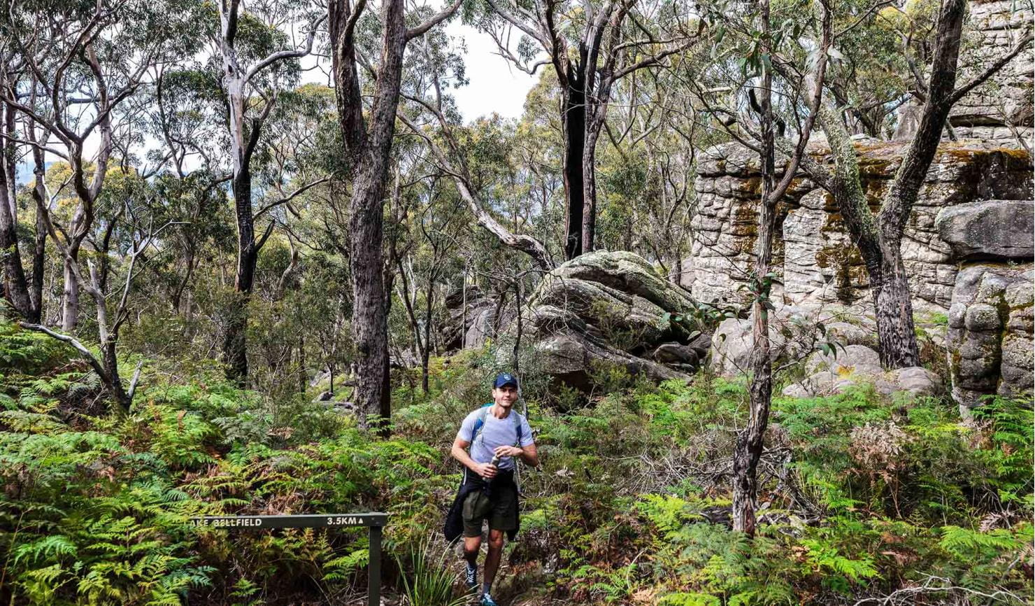
Explore the natural beauty of the Grampians from its world-famous hiking trails. Discover majestic waterfalls, dazzling spring wildflower displays and awe-inspiring mountain panoramas. Cross paths with kangaroos, wallabies, emus and native birds. Heritage-listed for its Aboriginal heritage, animal and plant life, and stunning natural beauty, the Grampians National Park is one of Australia's most recognisable places. The best way to appreciate it is on one of its many world-class walks or hikes or by taking a scenic drive.
Traditionally known as Gariwerd, this region is home to the largest number of significant and ancient Aboriginal rock art paintings and shelters in southern Australia. A visit to Brambuk – The National Park & Cultural Centre will help you get the most of your trip to these rock shelters.
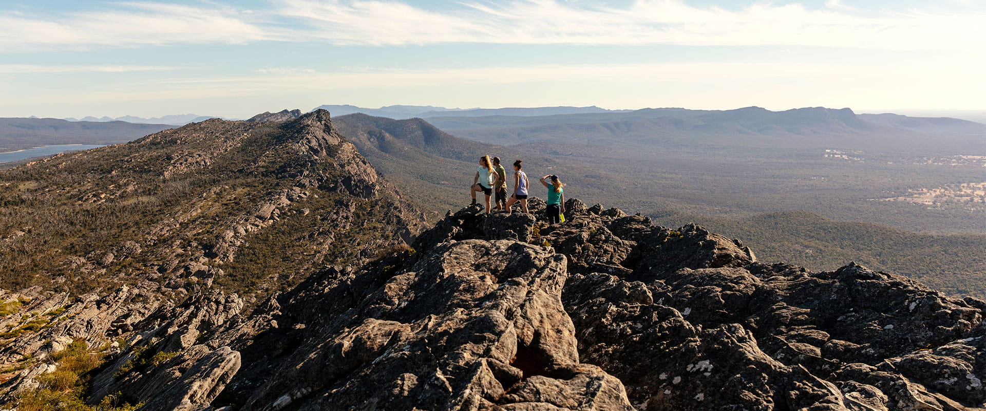
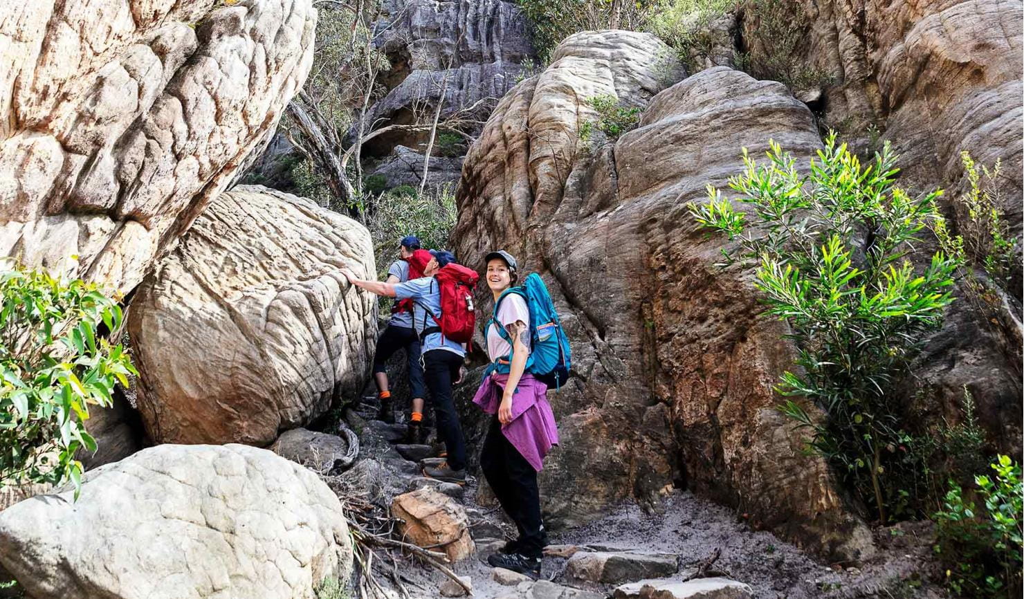
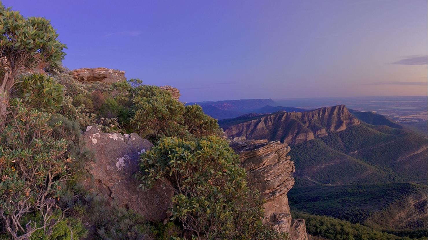
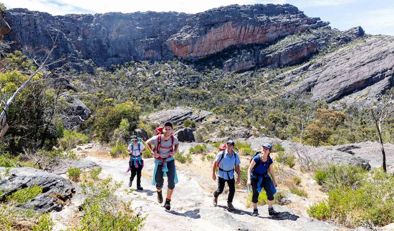
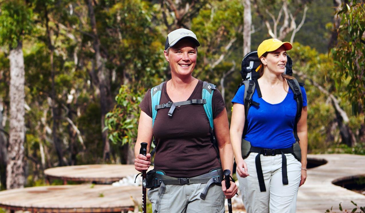
The Grampians draws walkers from around the world. Hike to the highest peak within the Grampians, Mount William, or explore the plethora of walks around Halls Gap and the Wonderland Range. Views from the Pinnacle are famous, but the steep walk should only be attempted by the fit. If you’re an experienced walker you’ll enjoy the unique challenge of the park’s overnight hikes. Choose from the iconic Grampians Peaks Trail, Major Mitchell Plateau or The Fortress and Mt Thackeray Overnight Hike.
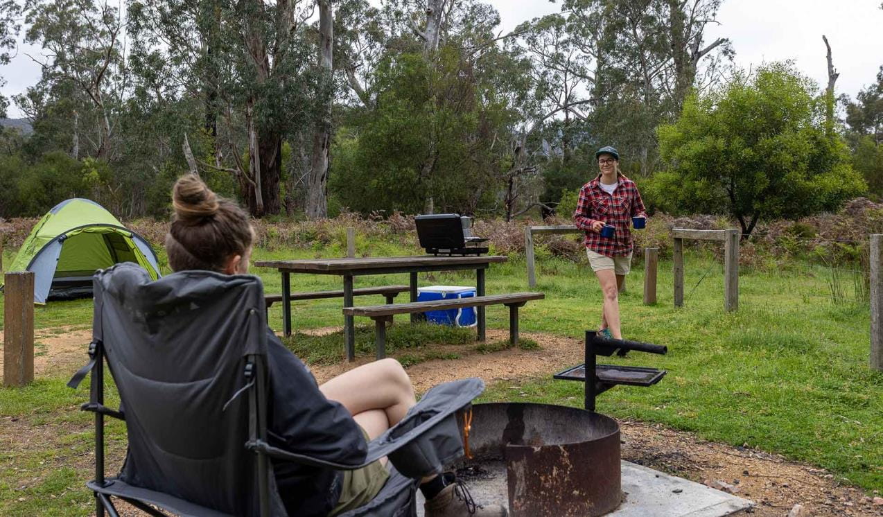
There are more relaxing pursuits to enjoy in the Grampians, too. Go fishing, canoeing or kayaking at Lake Wartook, Lake Bellfield and Moora Moora Reservoir or one of the park’s many other streams and creeks.
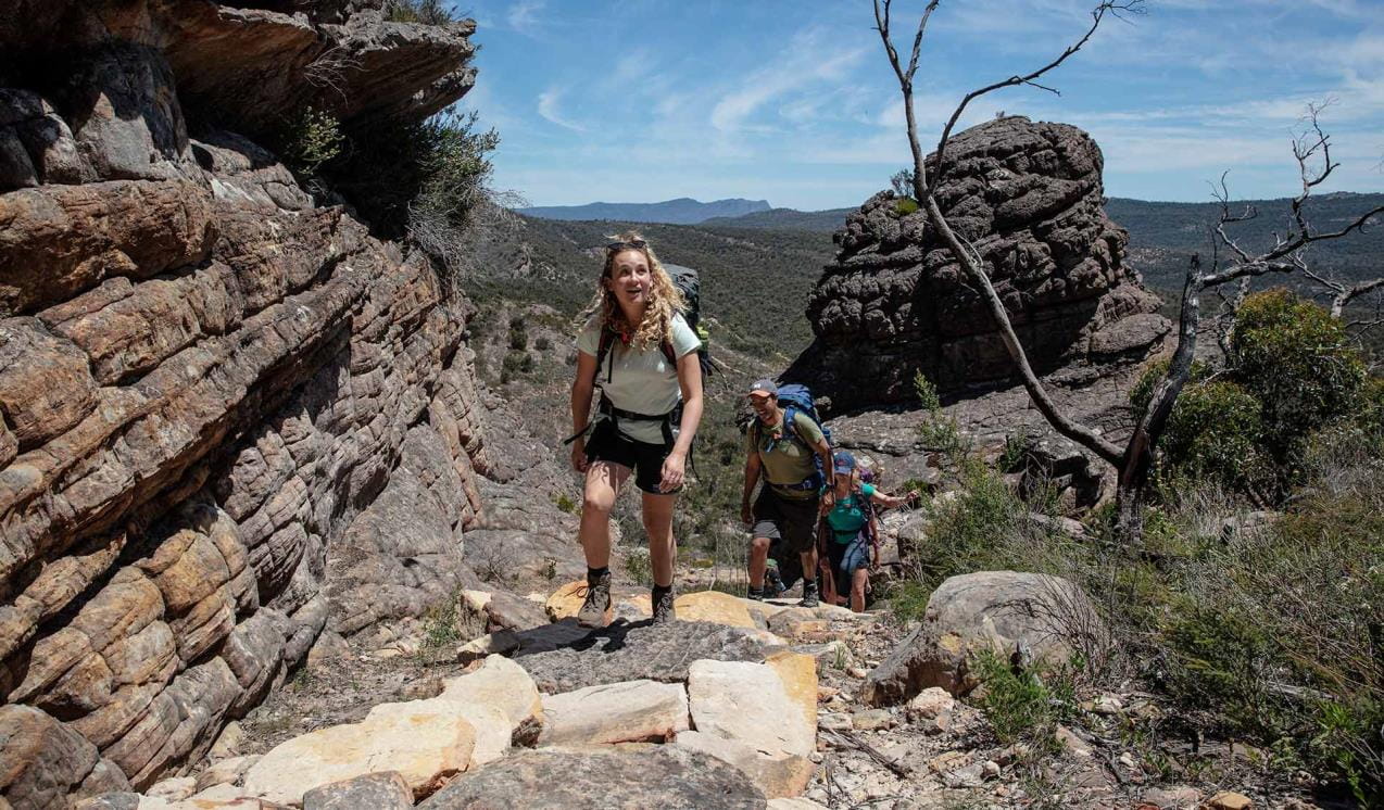
Grampians Peaks Trail
The Grampians Peaks Trail (164km) is a world-class 13-day hiking experience from Mt Zero in the north, through Halls Gap and finishing at Dunkeld in the south. It can also be completed in shorter sections.
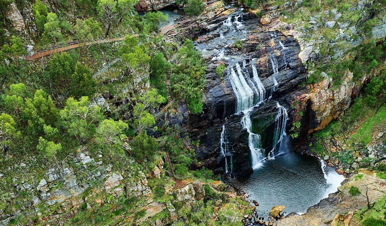
MacKenzie Falls
MacKenzie Falls is the most iconic and spectacular waterfall in the Grampians. Watch the majestic waterfall from the lookout platform or tackle the steep track to the base of the falls. Make the most of your day trip in the Grampians National Park with a strenuous walk through the beautiful MacKenzie River Gorge to Zumsteins Historic Area.
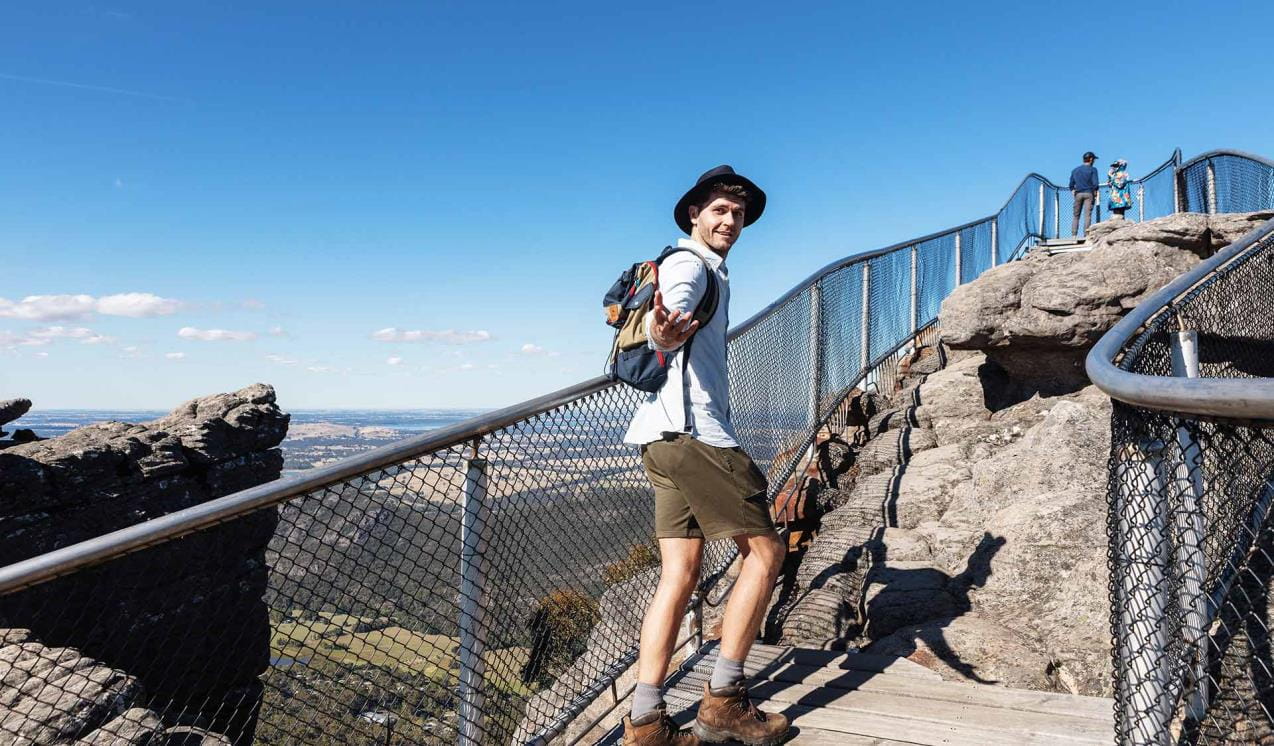
The Pinnacle walks
Choose from two different routes up to The Pinnacle lookout – an easy to medium walk from Sundial Carpark and a more challenging walk from Wonderland Carpark.
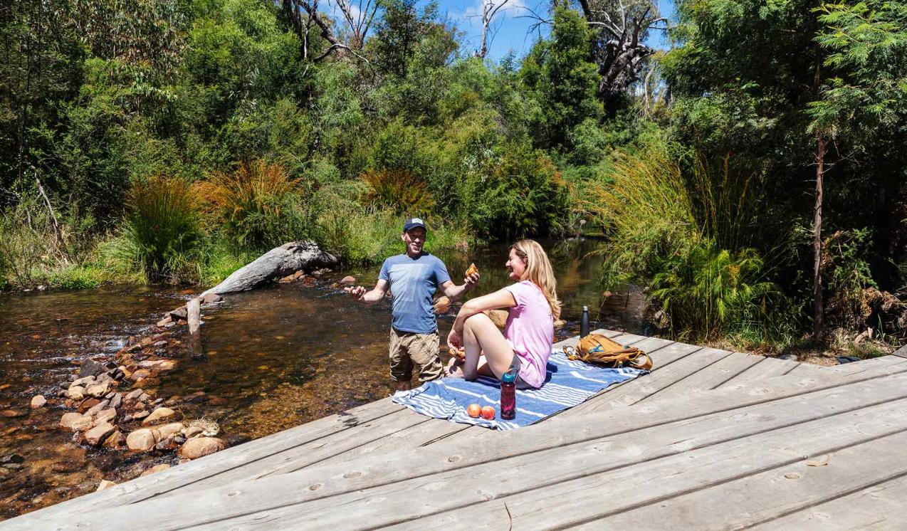
Zumsteins Historic Area
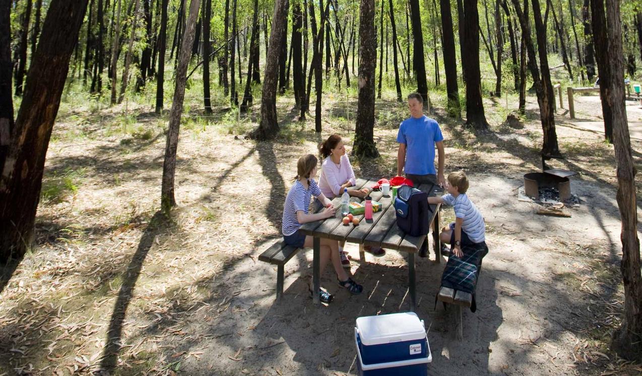
Zumsteins Picnic Area is located on the banks of the MacKenzie River and is the site of an historic settlement. It provides a great opportunity to relax in the natural setting of the Grampians, enjoy the wildlife, a barbecue and a short stroll.
Mount Stapylton Loop Walk
Hike through open forest and scramble over rocky outcrops on the Mount Stapylton Loop Walk. The adventurous walk will test your endurance as it dips into forested gullies and navigates the steep slope of Flat Rock. Fit walkers can tackle the challenging trek to the summit of Mount Stapylton for sweeping views of the Grampians.
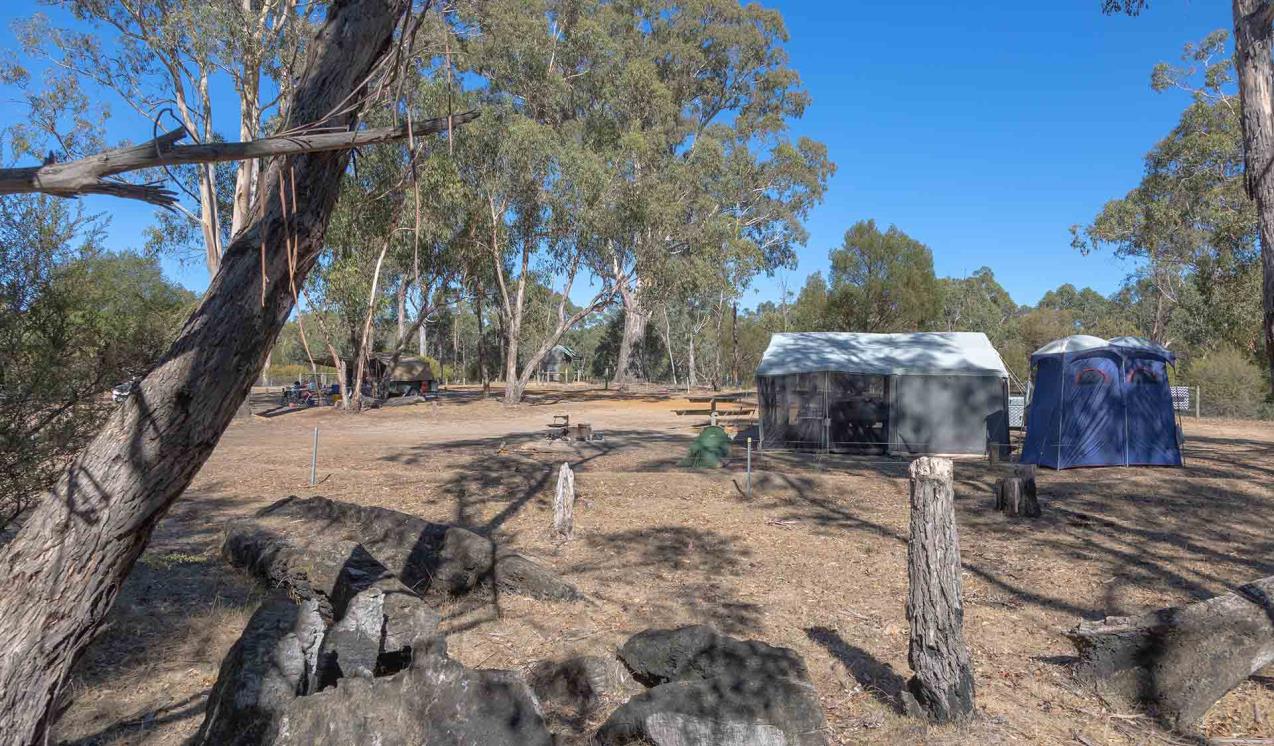
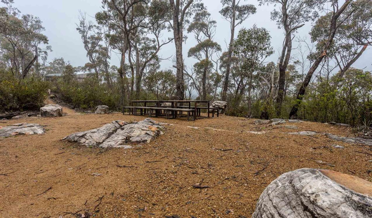
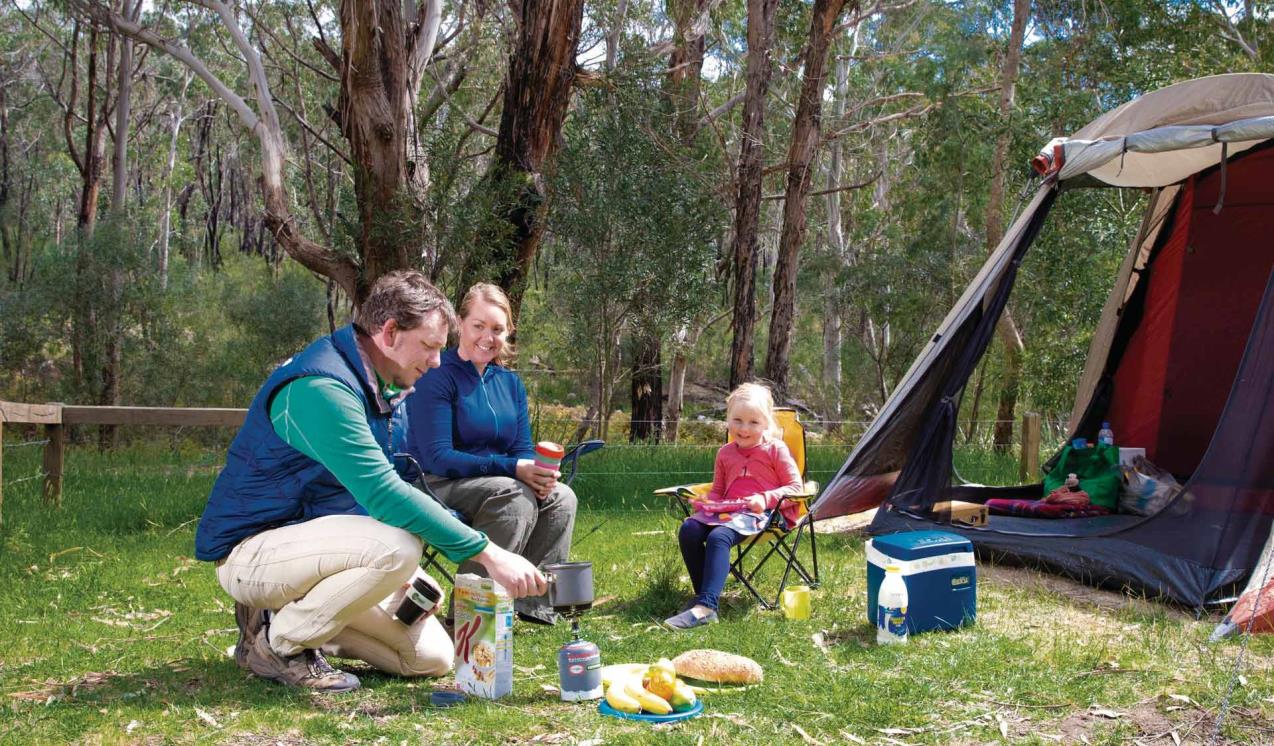
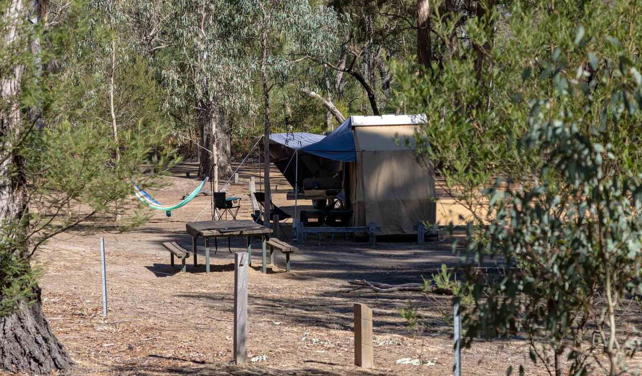
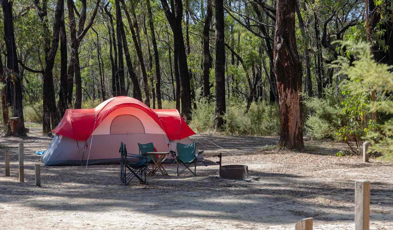
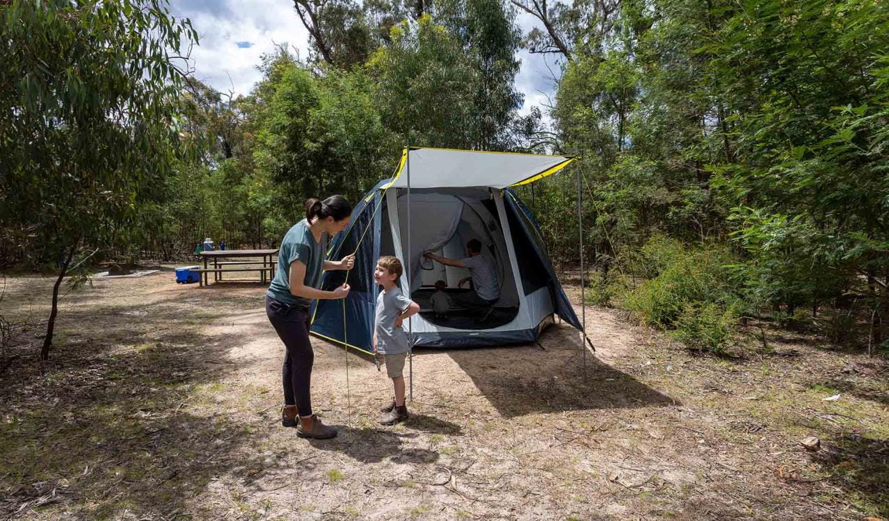
Boreang Campground
There are many locations for camping in the central region of the Grampians National Park including, Smiths Mill Campground, Borough Huts Campground, Boreang Campground and Jimmy Creek.
Jimmy Creek Campground
Jimmy Creek Campground is located in an open forest adjacent to the upper Wannon River. This campground is halfway between Halls Gap and Dunkeld, and is a great base for exploring both the Southern and Eastern Grampians.
Smiths Mill Campground
Smiths Mill Campground is positioned within heath woodland at the site of an old sawmill. It is centrally located a kilometre from Mackenzie Falls, and only a short drive to Boroka Lookout, Reed Lookout and Zumsteins Picnic Area.
Stony Creek Campground
Stony Creek Group Campground is available for schools or groups of up to 16 people undertaking overnight walks such as the Grampians Peaks Trail in the Wonderland and Mt Rosea areas. Vehicle accessible off Stony Creek road, this camping areas has a drop toilet, elevated timber tent platforms, a group gathering area and a day use shelter available. Bookings apply.
Borough Huts Campground
Borough Huts Campground is set in a tranquil forested area adjacent to Fyans Creek. It is close to Halls Gap, The Wonderland Range and a starting point for walks to Lake Bellfield and Mt Rosea.
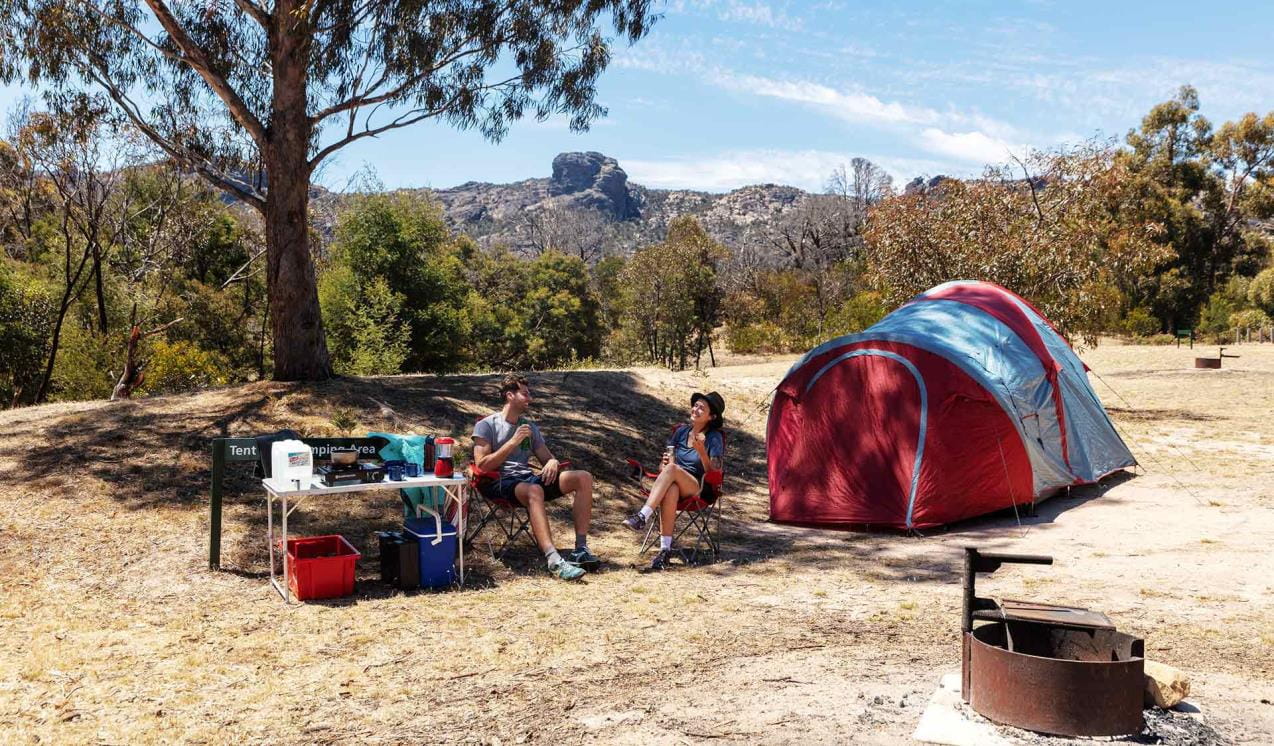
Stapylton Campground
Stapylton Campground is one of the best places to stay when exploring the Northern Grampians. It is close to a great selection of day walks, Aboriginal rock shelters, world-class rock climbing, picnic areas and day visitor sites.
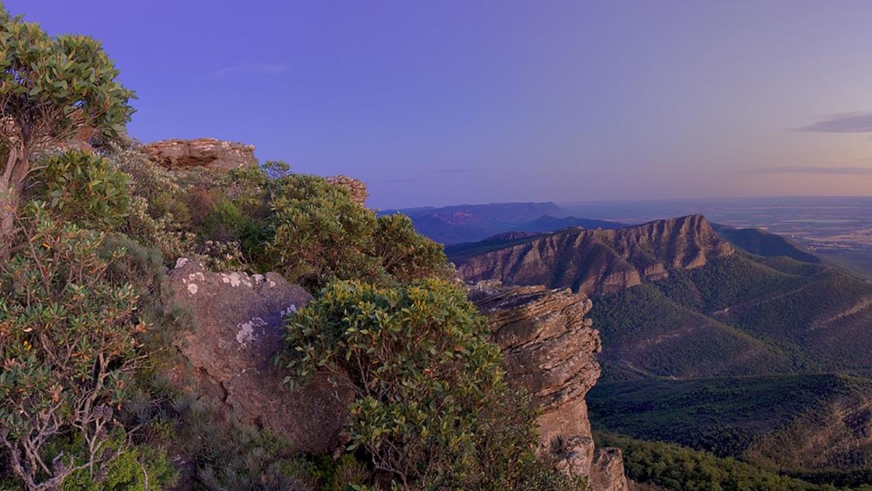
Mount William
Mount William or Duwul is the highest peak in the Grampians National Park (Gariwerd). This trailhead provides access to the challenging Mount William walk where you can obtain 360 degree views of the mountains and surrounding pastoral lands reward walkers for their efforts.
Buandik Campground
Buandik Campground is located in the Western Grampians at the base of the Victoria Range. The campground is set amongst open woodland beside Cultivation Creek and is close to the start of walks to Billimina and Manja rock art shelters and Buandik Falls.
First Wannon Hiker Camp-Major Mitchell Plateau
First Wannon Hiker Camp is a small clearing with limited space best positioned for small, single groups or individual walkers undertaking the remote overnight hike across the Major Mitchell Plateau.
Strachans Campground
Strachans Campground is located beside the headwaters of the Glenelg River at the site of a former timber mill. Strachans is perfectly situated to explore the Victoria Range and Victoria Valley, where there are opportunities for bushwalking, four wheel driving and rock climbing.
Troopers Creek Campground
Located in the northern Grampians, just south of Roses Gap, Troopers Creek Campground is set amongst tall Eucalypts and heathy shrubland, providing impressive views of Mt Difficult.
When you're there
Download the Grampians National Park visitor guide for more information about the park and a map.
Please note that for visitor and staff safety, MacKenzie Falls precinct (including Fish Falls) will be closed on days of Extreme and Catastrophic Fire Danger. Check the Fire Danger Rating forecast before you visit at cfa.vic.gov.au.
Need to know
Grampians National Park
Where to climb
There are more than 100 designated rock climbing areas in the landscape including 13 bouldering areas. Most of these areas have multiple climbs within them.
Please note there are conditions to rock climbing in the Gariwerd landscape, including:
- Rock climbing can only occur in designated areas.
- Rock climbers are responsible for assessing and accepting the risks associated with climbing within these areas.
- Climbers are required to minimise the use of chalk and only use chalk coloured to match the rock surface.
- Adhere to signs and notifications and do not enter closed areas.
Find more information at Rock climbing in Gariwerd.
Go with a guide
Abseiling and rock climbing with a licensed tour operator is a great way to have a safe and supervised visit. There are a number of licensed tour operators offering abseiling, rock-climbing, and many other activities in the national park.
Accessibility
Boroka Lookout, Brambuk The National Park and Cultural Centre and Stapylton and Plantation Campgrounds have been assessed for accessibility.
The Grampians TrailRider is available for bookings. The TrailRider all-terrain wheelchair and TrailRider Volunteers are for park visitors with low mobility to explore the natural beauty of Grampians National Park. The TrailRider is fitted with an electric motors to assist operators on steeper sections of walking tracks. Chair passengers are required to wear a bike helmet.
The TrailRider all-terrain wheelchair and TrailRider Volunteer service are both free of charge, however, please book a week in advance. For more information and to book the TrailRider contact the Brambuk National Park & Cultural Centre on (03) 8427 2058. For booking TrailRider volunteers contact the Volunteer Coordinator on volunteer@parks.vic.gov.au.
Assistance dogs are welcome in Parks Victoria parks and reserves. Entry requirements apply for parks and reserves that are usually dog prohibited, such as national parks.
Subscribe to Parks Victoria
Sign up to receive the latest ideas, inspiration and news delivered right to your inbox.
Change of Conditions
Nature being nature, sometimes conditions can change at short notice. It’s a good idea to check this page ahead of your visit for any updates.
-
Notices Affecting Multiple Sites
Grampians Planned Burn advice - Re-openings for ANZAC Day and weekend
FFMVIC has recently conducted 5 planned burns within Grampians (Gariwerd) National Park.With a cool change passing through on Tuesday night (23rd April), ignition has now ceased and crews are now completing hazard assessments in preparation for the burn areas to re-open.Planned burns will be patrolled over the coming weekend until officially declared safe. Under regulations, visitors are not permitted to enter burn areas that remain closed.Millstream Creek burn (3km East of Smiths Mill Campground, 20km West of Halls Gap)Smiths Mill Campground was recently closed to support planned burn operations. Ignition has now ceased and crews are now completing hazard assessments in preparation for the burn areas to re-open.With mild weather conditions forecast over the coming days, visitors may still see minimal fire activity and may be impacted by smoke. For advice on how this may impact your health, visit www.epa.vic.gov.au/smokeFFMVIC crews will continue patrolling the burn area east of the campground into the weekend.Partial Re-opening Wednesday April 24th 17:00hrsBoroka LookoutLake Wartook LookoutMt Difficult Road between Boroka Lookout and Lake WartookPartial Reopening - Thursday April 25th 08:00hrsSmiths Mill Campground *Note - Vehicle access is available only via Mt Victory Road and Lake Wartook Road. Arrivals tonight to be supported by FFMVIC CrewsOperational closures throughout the coming week:Old Mill Road (Between Smiths Mill and Boroka Lookout)Rose Creek Road (North between Mt Victory Road and Old Mill Road)Ricky Track (MVO)For any further information on the burn operations please contact Wimmera Fire District (03) 8508 1222For bookings or cancellations advice please contact Parks Victoria Information Centre Ph 13 1963For local park information and advice please contact Brambuk the National Park and Cultural Centre Phone 8427 2058 Cassidy Gap GR-WIM-CAV-00071 (3km north of Dunkeld)Section S3 of the Grampians Peaks Trail and some day walks north of Dunkeld have been closed due to Planned burn operations. Ignition has now ceased and crews will new undertake risk treatments in preparation for the burn unit to open.With mild weather conditions forecast over the coming days, visitors may still see minimal fire activity in the range (west of Mud-dadjug and south of Cassidy Gap) and may be impacted by smoke. For advice on how this may impact your health, visit www.epa.vic.gov.au/smokeFFMVIC crews will continue patrolling the burn area into the weekend.Partial Re-opening of visitor areas Wednesday April 24th 17:00 hoursGrampians Peaks Trail Section S3 – Cassidy Gap to Piccaninny Car Park over Signal Peak to Dunkeld Reservoir RoadMud-dadjug Hike in CampgroundMt Abrupt day walkSignal Peak day walkCassidy Gap Road – From Grampians Road to Grampians Peaks Trail TrailheadDjardji-Djawara Hike in campground is open but depending on conditions may impacted by smokeMann’s Road east of the intersection with Victoria Valley RdOperational closures throughout the coming week:Cassidy Gap Road from closed from Cassidy Gap Trailhead to Serra Fireline (west side of the range)Serra Range Fireline is closed at the intersection of Vic Valley Road and Cassidy Gap RoadFor any further information on the burn operations please contact Wimmera Fire District (03) 8508 1222For bookings or cancellations advice please contact Parks Victoria Information Centre Ph 13 1963For local park information and advice please contact Brambuk the National Park and Cultural Centre Phone 8427 2058
 Oslers Track GR-WIM-HGP-0042FFMVIC have recently completed planned burning operations in the forest just south of Plantation Campground, 8km north of Halls Gap. Ignition has now ceased and crews will new undertake risk treatments in preparation for the burn unit to open.With mild weather conditions forecast over the coming days, visitors may still see minimal fire activity and may be impacted by smoke. For advice on how this may impact your health, visit www.epa.vic.gov.au/smokeFFMVIC crews will continue patrolling the burn area east of the campground into the weekend.Partial Reopening of visitor areas Wednesday April 24th 17:00hrsPlantation campgroundPines road openMt Zero RoadOperational Closures throughout the coming week:Oslers track (Between Red Gum Lease Track and Pines Road)Fire trails and bush camping in the burn area south of Plantation CampgroundFor any further information on the burn operations please contact Wimmera Fire District (03) 8508 1222For bookings or cancellations advice please contact Parks Victoria Information Centre Ph 13 1963For local park information and advice please contact Brambuk the National Park and Cultural Centre Phone 8427 2058
 Victoria Range GR-WIM-CAV-0009FFMVIC have recently completed planned burning operations in the Victoria Range area 36km north of Cavendish. Ignition has now ceased and crews will new undertake risk treatments in preparation for the burn unit to open.With mild weather conditions forecast over the coming days, visitors may still see minimal fire activity in the range immediately surrounding Strachans Campground and may be impacted by smoke.FFMVIC crews will continue patrolling the burn area into the weekend.Partial Re-opening of visitor areas Wednesday April 24th 17:00hrsGlenelg River RoadChimney Pots car park and walking trackDesignated climbing areas 100 – 104 in Victoria RangeDesignated Rock-Climbing Areas 92- 99 In the Southern end of the Victoria RangeSawmill TrackVictoria Range RoadFortress and Mt Thackeray overnight walkVisitor areas to re-open Thursday April 25th 2pm (depending on conditions)Strachans campgroundOperational closures throughout the coming week:NilNote - Mountain Lion Climbing area remains closed for management purposesFor any further information on the burn operations please contact Wimmera Fire District (03) 8508 1222For bookings or cancellations advice please contact Parks Victoria Information Centre Ph 13 1963For local park information and advice please contact Brambuk the National Park and Cultural Centre Phone 8427 2058
 Victoria Point GR-WIM-CAV-0064FFMVIC have recently completed planned burning operations in the Victoria Range area, 38km north of Cavendish. Ignition has now ceased and crews will new undertake risk treatments in preparation for the burn unit to open.With mild weather conditions forecast over the coming days, visitors may still see minimal fire activity in the range immediately surrounding Strachans Campground and may be impacted by smoke.FFMVIC crews will continue patrolling the burn area into the weekend.Visitor areas to re-open Wed April 24th 5pmGlenelg River RoadChimney Pots carpark and walking trackDesignated Climbing Areas 100 - 104 in the southern end of Victoria RangeDesignated Rock-Climbing Areas 92- 99 in the southern end of the Victoria RangeOperational closures throughout the coming weekGeerak trackFor any further information on the burn operations please contact Wimmera Fire District (03) 8508 1222For bookings or cancellations advice please contact Parks Victoria Information Centre Ph 13 1963For local park information and advice please contact Brambuk the National Park and Cultural Centre Phone 8427 2058
 Stay informed about the Autumn planned burns schedule:Visit & Sign Up: Sign up to Planned Burns Victoria www.vic.gov.au/plannedburns Set up automated notifications about upcoming planned burns on public land near you. There is no charge to sign up to receive text messages.Download: The Vic Emergency App. Set up a watch zone and choose to be notified about planned burns in the ‘alerts’ settingsCall: The Vic Emergency Hotline on 1800 226 226 and request an interpreter or assistance for hearing difficulties via the National Relay Service. IN AN EMERGENCY CALL 000Email: For specialist advice about planned burns in the Wimmera District you can contact Horsham FFMVic Office at wimmera.fuelmanagement@delwp.vic.gov.au or phone the office on (03) 8508 1222.For Information about park closures and park access within Grampians National Park:Visit: the Parks Victoria website: https://www.parks.vic.gov.au/places-to-see/parks/grampians-national-park#change-of-conditionsVisit or call: Brambuk the National Park and Cultural Centre – 277 Grampians Road Halls Gap, Ph 8427 2058Contact: For bookings and cancellations advice please call Parks Victoria Information Centre 13 1963 or email info@parks.vic.gov.au
Grampians National Park - Autumn planned burn season underway
Grampians (Gariwerd) National Park – Autumn Planned Program UnderwayForest Fire Management Victoria (FFMVic) have commenced the Autumn Planned Burning Program in Grampians (Gariwerd) National Park and surrounding reserves.These planned burns have been nominated and approved as part of the FFMVic three-year Joint Fuel Management Program for the Wimmera Fire District. Each burn has been designated to a year and season, though this may change depending on burn objectives and seasonal conditions. You can view the three-year plan at https://www.ffm.vic.gov.au/bushfire-fuel-and-risk-management/joint-fuel-management-programThe map attached, outlines the burns programmed for this year. Detailing the exact date and time of ignition can be difficult and the final decision to proceed may only be made on the day of the burn - once resources, weather conditions and local fuel moisture levels are deemed suitable. Once a burn is scheduled for ignition, FFMVIC will send out regular notifications.Some of the planned burns this Autumn may involve the temporary closure of visitor sites, roads and campgrounds within Grampians Gariwerd National Park and other reserves. This may include detours or closures of hike in campgrounds along the Grampians Peaks Trail, and other vehicle-based campgrounds.· Closures will be enforced for the duration of ignition and may remain in place for some days. Visitor sites will re-open once the burn is declared safe.· We recommend that you seek information and stay informed about the status of the planned burns scheduled near you.Stay informed about this Autumns planned burns schedule:Visit & Sign Up:Sign up to Planned Burns Victoria to set up automated notifications about upcoming planned burns on public land near you. There is no charge to sign up to receive text messages.
Sign up via Planned Burns Victoria at www.vic.gov.au/plannedburnsDownload: the VicEmergency AppSet up a watch zone and choose to be notified about planned burns in the ‘alerts’ settingsCall: the VicEmergency Hotline on 1800 226 226 and request an interpreter or assistance for hearing difficulties via the National Relay ServiceEmail: For specialist advice about planned burns in the Wimmera District you can contact Horsham FFMVic Office at wimmera.fuelmanagement@delwp.vic.gov.au or phone the office on (03) 8508 1222.For Information about park closures and campground bookings within Grampians National Park:Visit the Parks Victoria website: https://www.parks.vic.gov.au/places-to-see/parks/grampians-national-park#change-of-conditionsVisit: Brambuk the National Park and Cultural Centre – 277 Grampians Road Halls Gap, Ph 8427 2058or for bookings and cancellations advice contact the Parks Victoria Information Centre Ph 13 1963 or email info@parks.vic.gov.au -
Grampians National Park
Mountain Lion (Designated rock-climbing and bouldering area) – Temporary exclusion
Mountain Lion (Designated rock-climbing and bouldering area) – Temporary exclusionSignificant Aboriginal cultural values have recently been rediscovered at the Mountain Lion designated rock-climbing and bouldering area.While Parks Victoria and Gariwerd Traditional Owners determine a longer-term management response, and out of respect for this significant cultural landscape, visitors are requested to not access this area.The Aboriginal Heritage Act 2006 protects Aboriginal cultural heritage and significant financial penalties apply for harm caused by individuals or corporate bodies.For more information please visit the FAQ Update at the Rock Climbing in Gariwerd link below.Pest animal control program in the Grampians – Deer and feral goats 29.04.2024 – 03.05.2024
An ongoing conservation program in the Grampians (Gariwerd) National Park will be supported this month by a ground control operation targeting deer and feral goats.Weather permitting, a ground shooting operation will be undertaken on weekdays between 29 April – 3 May to target these pest animals in remote parts of the Grampians (Gariwerd) National Park (see attached fact sheet with map).During this time Boreang Campground will be closed.To ensure visitor safety, warning signs will be placed at campgrounds and at major road access points to the control area. Visitors are encouraged to follow all instructions on permanent and temporary signage.Informed by scientific research, this program is aimed at controlling/reducing introduced deer and goat populations that are threatening the important natural and cultural values of the Greater Gariwerd Landscape.For further information please contact 13 1963.Attachments: Notification - Fact sheet - Grampians Deer Control April 2024 (540KB)
-
Grand Canyon Loop Walk (Grampians National Park)
Grand Canyon (south-eastern exit) closed until further notice
The steel staircase at the south-eastern exit of the canyon is closed due to an engineering issue. The Grand Canyon remains partially open as a return walk from Wonderland Carpark. The Pinnacle walk remains open via the Canyon bypass walking track. -
Silverband Falls Walk (Grampians National Park)
Silverband Falls Walking Track - Temporary Walking Grade change
Silverband Falls walking track has recently reopened after flood damage in Spring 2022. Please note that the track has temporarily changed from a walking Grade 2 to Grade 3 in difficulty which impacts accessibility. Grade 3 includes short steep sections, rough surface areas, and occasional steps. The change is temporary, and Silverband Falls track will be returned to a Grade 2 track via future flood recovery work.
Tours and adventure experiences in parks
One of the best ways you can get into nature is with a Licensed Tour Operator.
There are more than 400 Licensed Tour Operators across Victoria who are ready and waiting to help you experience and connect with Victoria’s spectacular parks and waterways.
Discover more than 60 different types of nature-based experiences including hiking, mountain biking, boating, four-wheel driving, indigenous culture tours, birdwatching, surfing, diving and so much more.
Licensed Tour Operators know all the best places to go and will plan and prepare your visit to ensure you are safe and can enjoy your nature-based adventure to the fullest.
How we keep it special
The Greater Gariwerd Landscape Management Plan sets management directions for the landscape over the next 15 years to protect the parks and reserves for current and future generations.
The Grampians (Gariwerd) Conservation Action Plan provides directions for environmental conservation management across the diverse landscape which includes Grampians National Park. This covers the sandstone peaks, heathlands, forests and wetlands.
GPT Trailheads upgrades
To provide more options to access the Grampians Peaks Trail, a range of new and upgraded access points and trailheads are being developed along the trail. The upgrades planned will vary between sites, and may include improved carparking and landscaping, additional water tanks, toilets, visitor and interpretive information about the Gariwerd landscape and culture.
Mackenzie Falls revitalisation
To better cater for visitors, including managing visitor safety and potential impacts on the landscape, the Mackenzie Falls area is being revitalised. The project is likely to include improved education and interpretive signage, track improvements and all-abilities access, potential track extensions, safety improvements, new facilities, and parking and congestion management.