Traditionally known as Gariwerd, the Grampians and the surrounding region has a fascinating Aboriginal history. Make Brambuk – The National Park & Cultural Centre in Halls Gap your first stop. Here you can explore what Gariwerd-Grampians means to Aboriginal people and find general information about visiting the Grampians National Park.
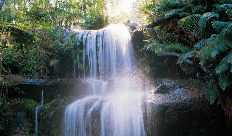
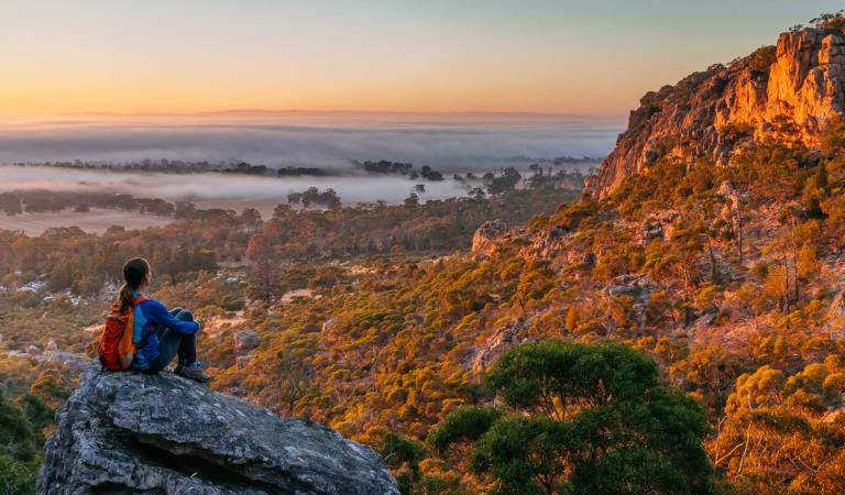
Grampians is most famous for its spring wildflowers, Aboriginal culture and cascades and waterfalls. Take a short journey to the iconic and enduring MacKenzie Falls. Or venture deeper along trails into the rugged landscape to discover the slither of Silverband, cascades of Fish or Turret Falls.
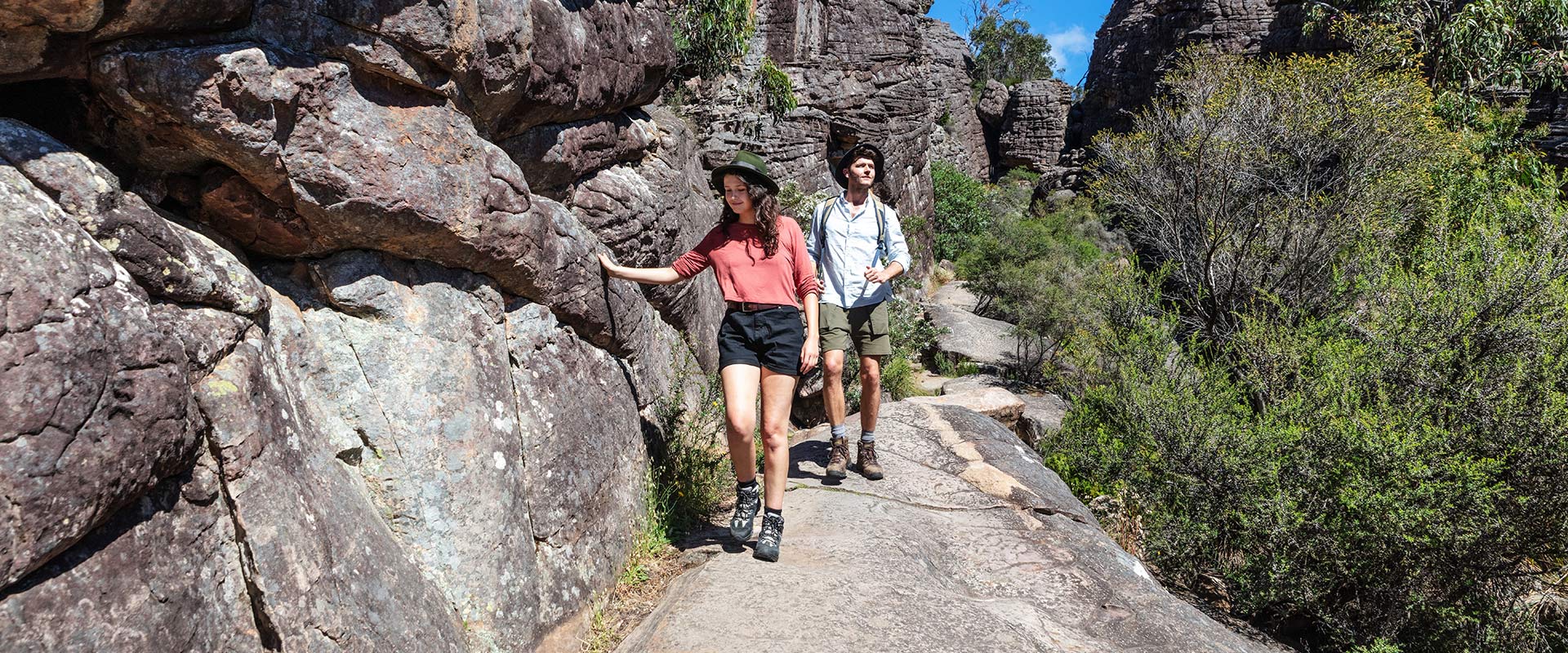
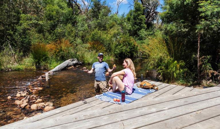
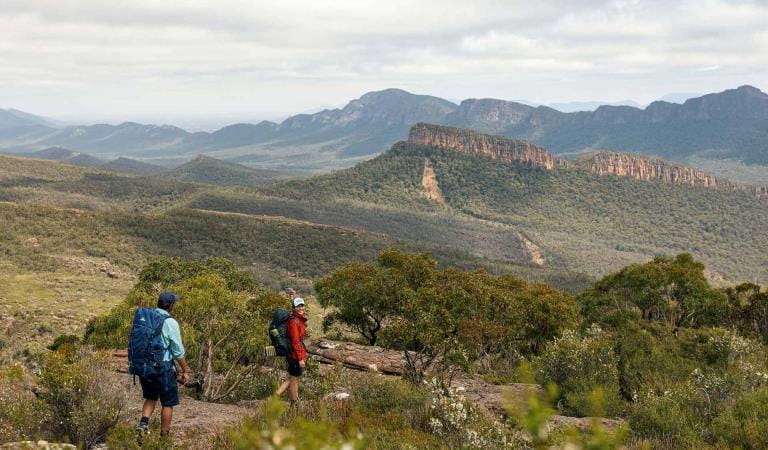
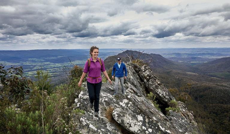
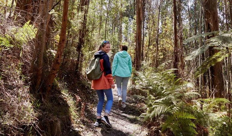
Bushwalking in the Wonderland from its carpark near Halls Gap is aptly named. A hike to the Pinnacle is very popular despite being a strenuous walk. An easier and no less spectacular view can be had by walking the Lakeview Loop from Sundial Carpark. Venus Baths is a delight for all with its refreshing spa-like rock pools. It is another easy walk from Halls Gap along the Stony Creek.
If you’re an experienced walker you’ll enjoy the unique challenge of the park’s overnight hikes. A section of the iconic Grampians Peaks Trail starts at Halls Gap. Visit the website for further details.
There are lakes here too! Go fishing, canoeing, kayaking or sailing. Lake Wartook, Lake Bellfield and Moora Moora Reservoir all have access.
The Grampians is a special place for nature lovers and there is something to see in all seasons.
Things to do
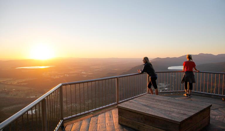
Boroka Lookout
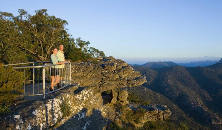
Reeds Lookout
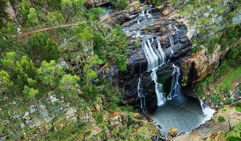
MacKenzie Falls
Zumsteins Historic Area
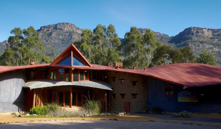
Brambuk The National Park and Culture Centre
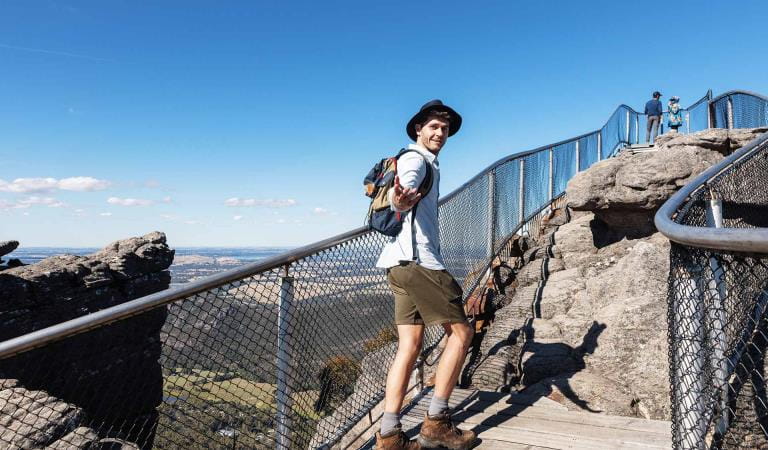
The Pinnacle walks
Grampians Peaks Trail
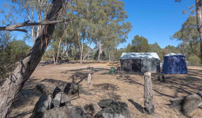
Boreang Campground
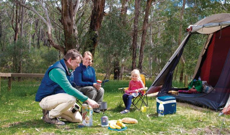
Borough Huts Campground
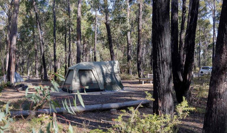
Smiths Mill Campground
How to get there
Central Grampians
When you're there
Need to know
Central Grampians
Accessibility
A Trailrider all-terrain wheelchair and Sherpa Volunteers are now available for park visitors with limited mobility to explore the natural beauty of Grampians National Park. The Grampians has two TrailRiders available for visitors and both of these chairs are fitted with electric motors to assist operators on steeper sections of track. Passengers must wear a helmet.
The TrailRider all-terrain wheelchair and Volunteer Sherpa service is free of charge however please book a week in advance. To book the TrailRider please contact Brambuk – The National Park and Cultural Centre on (03) 8427 2058. To book a Volunteer Sherpa please contact the Volunteer Sherpa Coordinator on (03) 8427 3541 or volunteersherpa@parks.vic.gov.au
Assistance dogs are welcome in Parks Victoria parks and reserves. Entry requirements apply for parks and reserves that are usually dog prohibited, such as national parks.
Change of Conditions
Nature being nature, sometimes conditions can change at short notice. It’s a good idea to check this page ahead of your visit for any updates.
-
Grampians National Park
Mountain Lion (Designated rock-climbing and bouldering area) – Temporary exclusion
Mountain Lion (Designated rock-climbing and bouldering area) – Temporary exclusionSignificant Aboriginal cultural values have recently been rediscovered at the Mountain Lion designated rock-climbing and bouldering area.While Parks Victoria and Gariwerd Traditional Owners determine a longer-term management response, and out of respect for this significant cultural landscape, visitors are requested to not access this area.The Aboriginal Heritage Act 2006 protects Aboriginal cultural heritage and significant financial penalties apply for harm caused by individuals or corporate bodies.For more information please visit the FAQ Update at the Rock Climbing in Gariwerd link below.Pest animal control program in the Grampians – Deer and feral goats 29.04.2024 – 03.05.2024
An ongoing conservation program in the Grampians (Gariwerd) National Park will be supported this month by a ground control operation targeting deer and feral goats.Weather permitting, a ground shooting operation will be undertaken on weekdays between 29 April – 3 May to target these pest animals in remote parts of the Grampians (Gariwerd) National Park (see attached fact sheet with map).During this time Boreang Campground will be closed.To ensure visitor safety, warning signs will be placed at campgrounds and at major road access points to the control area. Visitors are encouraged to follow all instructions on permanent and temporary signage.Informed by scientific research, this program is aimed at controlling/reducing introduced deer and goat populations that are threatening the important natural and cultural values of the Greater Gariwerd Landscape.For further information please contact 13 1963.Attachments: Notification - Fact sheet - Grampians Deer Control April 2024 (540KB)
Grampians (Gariwerd) National Park - Bushfire Closures Update - April 26, 2024
Grampians (Gariwerd) National Park was impacted by the Bellfield and Stapylton bushfires from 13th February 2024. There are temporary closures still in place in the vicinity of the fires. Visitors are asked to adhere to road and park closures as we work to assess and re-open these areas.Northern Grampians (Mt Stapylton Fire) Closures remaining April 26, 2024:Road/track closures east of Mt Zero RoadGolton trackCrutes track/Crutes roadNo off-track walking within the burnt areaMt William Range (Bellfield Fire) - Closures remaining April 26, 2024Tunnel Walking TrackMt Cassell TrackPomonal FirelineBirdrock RdNo off-track walking within the burnt areaAll other areas of the Grampians (Gariwerd) National Park previously closed due to the fires have been re-opened.For further information about the closures, please visit Brambuk the National Park & Cultural Centre, or call (03) 8427 2258. For National Park Information visit www.parks.vic.gov.au, or for booking refunds email info@parks.vic.gov.auPlease visit www.emergency.vic.gov.au for emergency updates, or free call 1800 226 226. Monitor the Emergency Vic app for alerts and warnings or listen to your local ABC radio stations for emergency broadcasts.Grampians (Gariwerd) National Park - Roads Update 26.04.2024
The Grampians (Gariwerd) National Park has several roads temporarily closed for repair works, upgrades, and recent fire impacts. Please be aware the movement of visitors in these parts of the National Park is restrictedPlanned Burn Road ClosuresOld Mill Rd from Smiths Mill Campground to Mt Difficult Rd (Boroka Lookout)Rose Creek Road from Mt Victory Rd to Old Mill RdCassidy Gap Rd closed from Cassidy Gap GPT Trailhead to Serra Fireline (MVO)Geerack TrackOslers Track between Red Gum Lease and Pines RdRoad Closures
Mitchell Road is closed between Redman Road and Mt William Picnic Ground Road.Seasonal Closures
Launders and Sanders Tracks are closed.Moora Moora Track is partially closed in the southern section, from Homestead Track intersection to Glenelg River Road.Grampians Peaks Trail – Trailhead Access
Road access (Griffin Track) to the Griffin Trailhead for the Grampians Peaks Trail is open to 4WD vehicles only. Walkers can access the GPT on foot via the Griffin Track from the Grampians Tourist Road.Please see the latest road report attachment for full road and track details at the bottom of this page.Attachments: Grampians (Gariwerd) National Park - Road Report - 26.04.2024 (274KB)
-
Notices Affecting Multiple Sites
Temporary Closure Notification – Planned Burn – Jimmy Creek Rd
Temporary Closure Notification – Planned Burn – Jimmy Creek Rd
FFMVIC have scheduled ignition for the following Planned Burn within Grampians (Gariwerd) National Park.
Jimmy Creek Road (GR-WIM-HG-0103)
This burn is located, this burn is located in the south-east area of Grampians National Park, 8km E of Mirranatwa, 37km north of Dunkeld.
Start Date: Wednesday 1st May 2024
End Date: Wednesday 8th May 2024
Ignition is scheduled from Wednesday May 1st
For visitor safety and to allow FFMVIC staff to prepare and deliver the burn, temporary closures along the Grampians Peaks Trail and day walks will be in place. These will re-open when the burn, or specific areas of the burn are declared safe:
Closures from 5:00pm Tuesday April 30th until at least Friday May 3rd, 2024
- Grampians Peaks Trail (C5/S1) closed between Yarram Gap Rd and Jimmy Creek Rd.
- Yarram Hike-in Campground closed.
- Yarram Park Rd closed.
- Jimmy Ck Rd (between the Grampians Rd and Mafeking Rd) closed.
- Closure signage will be in place at roads, trailheads, and car parks. Please follow directions and do not enter closed areas.
Visitor access to remain open:
- Jimmy Creek Campground (may be impacted by smoke)
- Wannon Crossing Campground (may be impacted by smoke)
- Grampians Rd on Wednesday May 1st (with traffic management)
- Yarram Gap Rd
How will this burn impact my Grampians Peaks Trail experience?
The Grampians Peaks Trail (C5/S1) closed between Yarram Gap Rd and Jimmy Creek Rd.
This includes the Yarram Hike-in Campground. A detour along the Ingleton Fireline from Jimmy Ck Rd GPT crossing to the Yarram Gap Rd GPT crossing is available to Grampians Peaks Trail walkers. This is well marked with directional signage and a detour map available.
Please contact Brambuk the National Park and Cultural Centre – Ph 8427 2058 for further assistance with managing this section.

Stay informed about the Autumn planned burns schedule:
Visit & Sign Up: Sign up to Planned Burns Victoria www.vic.gov.au/plannedburns Set up automated notifications about upcoming planned burns on public land near you. There is no charge to sign up to receive text messages.
Download: The Vic Emergency App. Set up a watch zone and choose to be notified about planned burns in the ‘alerts’ settings
Call: The Vic Emergency Hotline on 1800 226 226 and request an interpreter or assistance for hearing difficulties via the National Relay Service. IN AN EMERGENCY CALL 000
Email: For specialist advice about planned burns in the Wimmera District you can contact Horsham FFMVic Office at wimmera.fuelmanagement@delwp.vic.gov.au or phone the office on (03) 8508 1222.
For Information about park closures and campground bookings within Grampians National Park:
Visit the Parks Victoria website: https://www.parks.vic.gov.au/places-to-see/parks/grampians-national-park#change-of-conditions
Visit: Brambuk the National Park and Cultural Centre – 277 Grampians Road Halls Gap, Ph 8427 2058 or for bookings and cancellations advice contact the Parks Victoria Information Centre Ph 13 1963 or email info@parks.vic.gov.au
You may see or smell smoke in the vicinity of the burn. For advice on how this may impact your health, visit www.epa.vic.gov.au/smokeGrampians National Park - Autumn planned burn season underway
Grampians (Gariwerd) National Park – Autumn Planned Program UnderwayForest Fire Management Victoria (FFMVic) have commenced the Autumn Planned Burning Program in Grampians (Gariwerd) National Park and surrounding reserves.These planned burns have been nominated and approved as part of the FFMVic three-year Joint Fuel Management Program for the Wimmera Fire District. Each burn has been designated to a year and season, though this may change depending on burn objectives and seasonal conditions. You can view the three-year plan at https://www.ffm.vic.gov.au/bushfire-fuel-and-risk-management/joint-fuel-management-programThe map attached, outlines the burns programmed for this year. Detailing the exact date and time of ignition can be difficult and the final decision to proceed may only be made on the day of the burn - once resources, weather conditions and local fuel moisture levels are deemed suitable. Once a burn is scheduled for ignition, FFMVIC will send out regular notifications.Some of the planned burns this Autumn may involve the temporary closure of visitor sites, roads and campgrounds within Grampians Gariwerd National Park and other reserves. This may include detours or closures of hike in campgrounds along the Grampians Peaks Trail, and other vehicle-based campgrounds.· Closures will be enforced for the duration of ignition and may remain in place for some days. Visitor sites will re-open once the burn is declared safe.· We recommend that you seek information and stay informed about the status of the planned burns scheduled near you.Stay informed about this Autumns planned burns schedule:Visit & Sign Up:Sign up to Planned Burns Victoria to set up automated notifications about upcoming planned burns on public land near you. There is no charge to sign up to receive text messages.
Sign up via Planned Burns Victoria at www.vic.gov.au/plannedburnsDownload: the VicEmergency AppSet up a watch zone and choose to be notified about planned burns in the ‘alerts’ settingsCall: the VicEmergency Hotline on 1800 226 226 and request an interpreter or assistance for hearing difficulties via the National Relay ServiceEmail: For specialist advice about planned burns in the Wimmera District you can contact Horsham FFMVic Office at wimmera.fuelmanagement@delwp.vic.gov.au or phone the office on (03) 8508 1222.For Information about park closures and campground bookings within Grampians National Park:Visit the Parks Victoria website: https://www.parks.vic.gov.au/places-to-see/parks/grampians-national-park#change-of-conditionsVisit: Brambuk the National Park and Cultural Centre – 277 Grampians Road Halls Gap, Ph 8427 2058or for bookings and cancellations advice contact the Parks Victoria Information Centre Ph 13 1963 or email info@parks.vic.gov.au
Similar experiences
Cathedral Range State Park
Mount Arapiles-Tooan State Park
Budj Bim National Park
Baw Baw National Park
Kinglake National Park