Explore
Stony Creek Campground
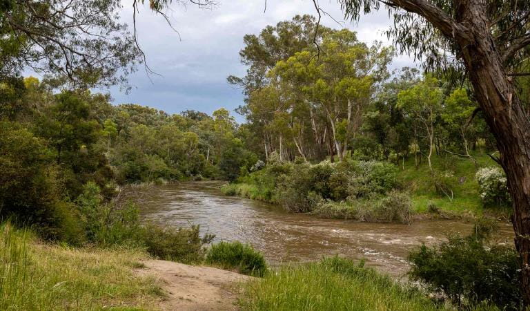
Nestled amongst the native pines and rocky outcrops near the towering peaks of Mt Rosea, this hike-in camping area is perfect for schools and groups undertaking the Grampians Peaks Trail and other overnight walks in the Wonderland and Mt Rosea areas.
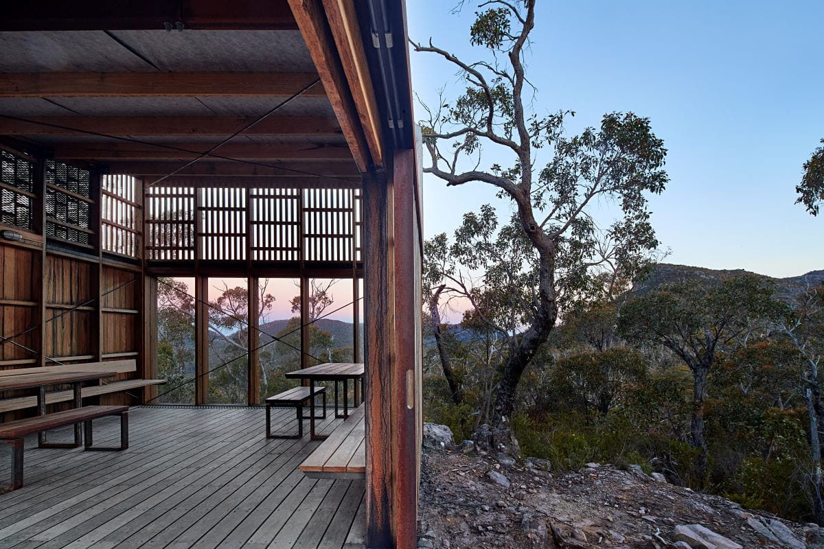
Stony Creek Campground is a designated group hike-in area that offers eight timber tent platforms, each accommodating up to two people.
Bookings are for exclusive use of the site, and available for groups no larger than 16 people.
Campground facilities include non-flush toilet, communal gathering area, day use shelter and untreated water tanks. Whilst there is untreated rainwater tanks at this campground, we cannot guarantee there will be water.
Vehicle access and parking is available off Stony Creek Road for high clearance 4WD vehicles. Gate keys are provided by Brambuk the National Park and Cultural Centre upon confirmation of a booking.
Additional bush camps may be available along Stony Creek road and are allocated on a first in first served basis. Groups are required to register their overnight walks by completing an Education Group Activity Statement prior to arrival.
Things to do
The Pinnacle walks
Zumsteins Historic Area
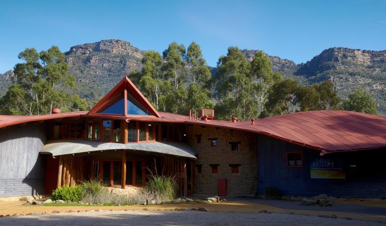
Brambuk The National Park and Culture Centre
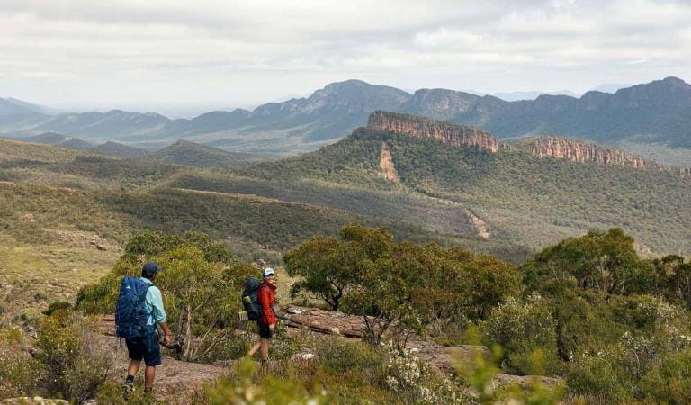
Grampians Peaks Trail
How to get there
Stony Creek Campground
Sites
When you're there
Pay a visit to Brambuk the National Park and Cultural Centre in Halls Gap, there you will find a range of guides which will help you to make the most of your visit to the Grampians. You can also learn about the rich Aboriginal culture of Gariwerd.
Download the Grampians National Park visitor guide to get the most out of your park visit.
Need to know
Stony Creek Campground
Safety tips for a great visit
Stay safe and get the most out of your park visit by preparing for natural hazards and other outdoor risks in Victoria’s parks. You are responsible for your own safety and the safety of those in your care.
Accessibility
Visiting a park can be more of a challenge for people with disabilities, however in Victoria there are a wide range of facilities to help people of all abilities enjoy our wonderful parks around the state.
Bushfire awareness
Stony Creek Campground in the Grampians National Park is in the Wimmera fire district. Bushfire safety is a personal responsibility. Anyone entering the park during the bushfire season needs to stay aware of forecast weather conditions. Check the Fire Danger Rating and for days of Total Fire Ban at emergency.vic.gov.au, on the Vic Emergency App or call the Vic Emergency Hotline 1800 226 226.
No fires may be lit on Total Fire Ban days. On Catastrophic Fire Danger Rating days this park will be closed for public safety. Closure signs will be erected but do not expect an official warning.
Change of Conditions
Nature being nature, sometimes conditions can change at short notice. It’s a good idea to check this page ahead of your visit for any updates.
-
Grampians National Park
Mountain Lion (Designated rock-climbing and bouldering area) – Temporary exclusion
Mountain Lion (Designated rock-climbing and bouldering area) – Temporary exclusionSignificant Aboriginal cultural values have recently been rediscovered at the Mountain Lion designated rock-climbing and bouldering area.While Parks Victoria and Gariwerd Traditional Owners determine a longer-term management response, and out of respect for this significant cultural landscape, visitors are requested to not access this area.The Aboriginal Heritage Act 2006 protects Aboriginal cultural heritage and significant financial penalties apply for harm caused by individuals or corporate bodies.For more information please visit the FAQ Update at the Rock Climbing in Gariwerd link below.Pest animal control program in the Grampians – Deer and feral goats 29.04.2024 – 03.05.2024
An ongoing conservation program in the Grampians (Gariwerd) National Park will be supported this month by a ground control operation targeting deer and feral goats.Weather permitting, a ground shooting operation will be undertaken on weekdays between 29 April – 3 May to target these pest animals in remote parts of the Grampians (Gariwerd) National Park (see attached fact sheet with map).During this time Boreang Campground will be closed.To ensure visitor safety, warning signs will be placed at campgrounds and at major road access points to the control area. Visitors are encouraged to follow all instructions on permanent and temporary signage.Informed by scientific research, this program is aimed at controlling/reducing introduced deer and goat populations that are threatening the important natural and cultural values of the Greater Gariwerd Landscape.For further information please contact 13 1963.Attachments: Notification - Fact sheet - Grampians Deer Control April 2024 (540KB)
Grampians (Gariwerd) National Park - Bushfire Closures Update - April 26, 2024
Grampians (Gariwerd) National Park was impacted by the Bellfield and Stapylton bushfires from 13th February 2024. There are temporary closures still in place in the vicinity of the fires. Visitors are asked to adhere to road and park closures as we work to assess and re-open these areas.Northern Grampians (Mt Stapylton Fire) Closures remaining April 26, 2024:Road/track closures east of Mt Zero RoadGolton trackCrutes track/Crutes roadNo off-track walking within the burnt areaMt William Range (Bellfield Fire) - Closures remaining April 26, 2024Tunnel Walking TrackMt Cassell TrackPomonal FirelineBirdrock RdNo off-track walking within the burnt areaAll other areas of the Grampians (Gariwerd) National Park previously closed due to the fires have been re-opened.For further information about the closures, please visit Brambuk the National Park & Cultural Centre, or call (03) 8427 2258. For National Park Information visit www.parks.vic.gov.au, or for booking refunds email info@parks.vic.gov.auPlease visit www.emergency.vic.gov.au for emergency updates, or free call 1800 226 226. Monitor the Emergency Vic app for alerts and warnings or listen to your local ABC radio stations for emergency broadcasts.Grampians (Gariwerd) National Park - Roads Update 26.04.2024
The Grampians (Gariwerd) National Park has several roads temporarily closed for repair works, upgrades, and recent fire impacts. Please be aware the movement of visitors in these parts of the National Park is restrictedPlanned Burn Road ClosuresOld Mill Rd from Smiths Mill Campground to Mt Difficult Rd (Boroka Lookout)Rose Creek Road from Mt Victory Rd to Old Mill RdCassidy Gap Rd closed from Cassidy Gap GPT Trailhead to Serra Fireline (MVO)Geerack TrackOslers Track between Red Gum Lease and Pines RdRoad Closures
Mitchell Road is closed between Redman Road and Mt William Picnic Ground Road.Seasonal Closures
Launders and Sanders Tracks are closed.Moora Moora Track is partially closed in the southern section, from Homestead Track intersection to Glenelg River Road.Grampians Peaks Trail – Trailhead Access
Road access (Griffin Track) to the Griffin Trailhead for the Grampians Peaks Trail is open to 4WD vehicles only. Walkers can access the GPT on foot via the Griffin Track from the Grampians Tourist Road.Please see the latest road report attachment for full road and track details at the bottom of this page.Attachments: Grampians (Gariwerd) National Park - Road Report - 26.04.2024 (274KB)
-
Notices Affecting Multiple Sites
Temporary Closure Notification – Planned Burn – Jimmy Creek Rd
Temporary Closure Notification – Planned Burn – Jimmy Creek Rd
FFMVIC have scheduled ignition for the following Planned Burn within Grampians (Gariwerd) National Park.
Jimmy Creek Road (GR-WIM-HG-0103)
This burn is located, this burn is located in the south-east area of Grampians National Park, 8km E of Mirranatwa, 37km north of Dunkeld.
Start Date: Wednesday 1st May 2024
End Date: Wednesday 8th May 2024
Ignition is scheduled from Wednesday May 1st
For visitor safety and to allow FFMVIC staff to prepare and deliver the burn, temporary closures along the Grampians Peaks Trail and day walks will be in place. These will re-open when the burn, or specific areas of the burn are declared safe:
Closures from 5:00pm Tuesday April 30th until at least Friday May 3rd, 2024
- Grampians Peaks Trail (C5/S1) closed between Yarram Gap Rd and Jimmy Creek Rd.
- Yarram Hike-in Campground closed.
- Yarram Park Rd closed.
- Jimmy Ck Rd (between the Grampians Rd and Mafeking Rd) closed.
- Closure signage will be in place at roads, trailheads, and car parks. Please follow directions and do not enter closed areas.
Visitor access to remain open:
- Jimmy Creek Campground (may be impacted by smoke)
- Wannon Crossing Campground (may be impacted by smoke)
- Grampians Rd on Wednesday May 1st (with traffic management)
- Yarram Gap Rd
How will this burn impact my Grampians Peaks Trail experience?
The Grampians Peaks Trail (C5/S1) closed between Yarram Gap Rd and Jimmy Creek Rd.
This includes the Yarram Hike-in Campground. A detour along the Ingleton Fireline from Jimmy Ck Rd GPT crossing to the Yarram Gap Rd GPT crossing is available to Grampians Peaks Trail walkers. This is well marked with directional signage and a detour map available.
Please contact Brambuk the National Park and Cultural Centre – Ph 8427 2058 for further assistance with managing this section.

Stay informed about the Autumn planned burns schedule:
Visit & Sign Up: Sign up to Planned Burns Victoria www.vic.gov.au/plannedburns Set up automated notifications about upcoming planned burns on public land near you. There is no charge to sign up to receive text messages.
Download: The Vic Emergency App. Set up a watch zone and choose to be notified about planned burns in the ‘alerts’ settings
Call: The Vic Emergency Hotline on 1800 226 226 and request an interpreter or assistance for hearing difficulties via the National Relay Service. IN AN EMERGENCY CALL 000
Email: For specialist advice about planned burns in the Wimmera District you can contact Horsham FFMVic Office at wimmera.fuelmanagement@delwp.vic.gov.au or phone the office on (03) 8508 1222.
For Information about park closures and campground bookings within Grampians National Park:
Visit the Parks Victoria website: https://www.parks.vic.gov.au/places-to-see/parks/grampians-national-park#change-of-conditions
Visit: Brambuk the National Park and Cultural Centre – 277 Grampians Road Halls Gap, Ph 8427 2058 or for bookings and cancellations advice contact the Parks Victoria Information Centre Ph 13 1963 or email info@parks.vic.gov.au
You may see or smell smoke in the vicinity of the burn. For advice on how this may impact your health, visit www.epa.vic.gov.au/smokeGrampians National Park - Autumn planned burn season underway
Grampians (Gariwerd) National Park – Autumn Planned Program UnderwayForest Fire Management Victoria (FFMVic) have commenced the Autumn Planned Burning Program in Grampians (Gariwerd) National Park and surrounding reserves.These planned burns have been nominated and approved as part of the FFMVic three-year Joint Fuel Management Program for the Wimmera Fire District. Each burn has been designated to a year and season, though this may change depending on burn objectives and seasonal conditions. You can view the three-year plan at https://www.ffm.vic.gov.au/bushfire-fuel-and-risk-management/joint-fuel-management-programThe map attached, outlines the burns programmed for this year. Detailing the exact date and time of ignition can be difficult and the final decision to proceed may only be made on the day of the burn - once resources, weather conditions and local fuel moisture levels are deemed suitable. Once a burn is scheduled for ignition, FFMVIC will send out regular notifications.Some of the planned burns this Autumn may involve the temporary closure of visitor sites, roads and campgrounds within Grampians Gariwerd National Park and other reserves. This may include detours or closures of hike in campgrounds along the Grampians Peaks Trail, and other vehicle-based campgrounds.· Closures will be enforced for the duration of ignition and may remain in place for some days. Visitor sites will re-open once the burn is declared safe.· We recommend that you seek information and stay informed about the status of the planned burns scheduled near you.Stay informed about this Autumns planned burns schedule:Visit & Sign Up:Sign up to Planned Burns Victoria to set up automated notifications about upcoming planned burns on public land near you. There is no charge to sign up to receive text messages.
Sign up via Planned Burns Victoria at www.vic.gov.au/plannedburnsDownload: the VicEmergency AppSet up a watch zone and choose to be notified about planned burns in the ‘alerts’ settingsCall: the VicEmergency Hotline on 1800 226 226 and request an interpreter or assistance for hearing difficulties via the National Relay ServiceEmail: For specialist advice about planned burns in the Wimmera District you can contact Horsham FFMVic Office at wimmera.fuelmanagement@delwp.vic.gov.au or phone the office on (03) 8508 1222.For Information about park closures and campground bookings within Grampians National Park:Visit the Parks Victoria website: https://www.parks.vic.gov.au/places-to-see/parks/grampians-national-park#change-of-conditionsVisit: Brambuk the National Park and Cultural Centre – 277 Grampians Road Halls Gap, Ph 8427 2058or for bookings and cancellations advice contact the Parks Victoria Information Centre Ph 13 1963 or email info@parks.vic.gov.au
Similar experiences