
Explore
Notley Campground and Picnic Area
Womin-Dji-Ka (Welcome)
Greater Bendigo National Park is one of six jointly managed parks in Central West Victoria by the Dja Dja Wurrung Clans Aboriginal Corporation and Parks Victoria. For more information on Joint Management, please visit the Dja Dja Wurrung Clans Aboriginal Corporation and Dhelkunya Dja Land Management Board who oversee implementation of the Joint Management Plan 2018 - see relevant strategy and resources documents.
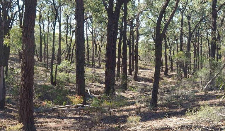
Notley Campground and Picnic Area has wide, grassy spaces for family-friendly camping and is surrounded by Box-Ironbark bushland with a number of bushwalks nearby.
The Old Tom Mine site is an easy 30 minute return walk, and is a popular spot for fossicking and prospecting. Explore remnants of both alluvial and quartz reef gold mining techniques from the 1800s. See the Old Tom Reef mine, the remains of a puddling machine and the site of old cyanide vats, used to reclaim gold from old tailings sands.
Continue on to Flagstaff Hill for a panoramic lookout view across the surrounding landscape.
Things To Do
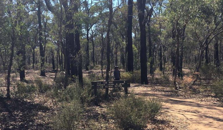
Old Tom Mine Walk
Flagstaff Hill Loop Walk
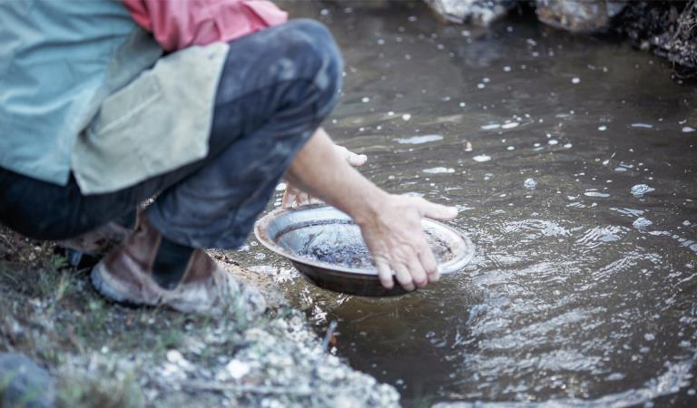
Fossicking and prospecting
How to get there
Notley Campground and Picnic Area
Access is via the unsealed Neilborough Road.
The road and parking area are suitable for caravans and campervans and small buses. There are drive-through sites available for caravans, camper trailers and motor homes.
When you're there
The campsite has parking for cars and caravans, toilets (no handwashing facilities), fireplaces with grills and a large covered area with picnic tables.
Fires can only be lit in the fireplace provided, and if it is not a day of Total Fire Ban.
Firewood collection is not allowed, as woody debris provides important habitat for many animals that live in the park.
There are no bins or water at the site, so remember to bring your own water and take your rubbish away with you when you leave.
Watch out for snakes in warmer weather, and be careful not to park or camp under trees as there is a risk of falling branches.
Horses and dogs are not permitted.
Drones are not allowed within the park.
Need to know
Notley Campground and Picnic Area
Accessibility
Visiting a park can be more of a challenge for people with disabilities, however in Victoria there are a wide range of facilities to help people of all abilities enjoy our wonderful parks around the state.
The covered picnic area is wheelchair accessible.
The toilets are not wheelchair accessible.
Assistance dogs are welcome in Parks Victoria parks and reserves. Entry requirements apply for parks and reserves that are usually dog prohibited, such as national parks.
Safety in nature
To ensure that you and your companions stay safe, always remember that the natural environment can be unpredictable. Before you go, take a look at our safety tips and check our changed conditions and closures information for a great visit.
Visitors are reminded not to park or rest under or near large trees, as trees and branches may fall at any time.
Change of Conditions
Nature being nature, sometimes conditions can change at short notice. It’s a good idea to check this page ahead of your visit for any updates.
-
Greater Bendigo National Park
Planned burn near Tennyson Road
Planned burning operations are scheduled in the Greater Bendigo National Park which will result in parts of the park near Tennyson Road being closed from the time a burn is approved for ignition until the area is declared safe. Ignition of the burn is scheduled from Saturday 27 April - Friday 3 May 2024 and is subject to favourable weather.
Please see attached neighbour letter for more information, including maps.Burn name: LM-MGF-BGO-1321 Kamarooka - Tennyson Rd, Size: 290.47 hectares, Location: 7km Southeast of KamarookaScheduled Date: Saturday 27 April - Friday 3 May 2024 (weather conditions permitting)For more information- DEECA’s Neighbour letter, attached
- DEECA’s planned burn website https://plannedburns.ffm.vic.gov.au/
Planned burn - near Tennyson Road
Planned burning operations are scheduled in the Greater Bendigo National Park which will result in parts of the park near Tennyson Road being closed from the time a burn is approved for ignition until the area is declared safe. Ignition of the burn is scheduled from Saturday 27 April - Friday 3 May 2024 and is subject to favourable weather.
Please see attached neighbour letter for more information, including maps.Burn name: LM-MGF-BGO-1321 Kamarooka - Tennyson Rd, Size: 290.47 hectares, Location: 7km Southeast of KamarookaScheduled Date: Saturday 27 April - Friday 3 May 2024 (weather conditions permitting)For more information- DEECA’s Neighbour letter, attached
- DEECA’s planned burn website https://plannedburns.ffm.vic.gov.au/
Planned burn - near Edwards Road
Planned burning operations are scheduled in the Greater Bendigo National Park which will result in parts of the park near Edwards Road being closed from the time a burn is approved for ignition until the area is declared safe. Ignition of the burn is scheduled from Sunday 28 April to Saturday 4 May 2024 and is subject to favourable weather.
Please see attached neighbour letter for more information, including maps.Burn name: LM-MGF-BGO-0472 Flora Hill - Edwards Rd, Size: 62.05 hectares, Location: 3.7km SE of BendigoScheduled Date: Sunday 28 April to Saturday 4 May 2024 (weather conditions permitting)For more information- DEECA’s Neighbour letter, attached
- DEECA’s planned burn website https://plannedburns.ffm.vic.gov.au/
- DEECA’s Neighbour letter, attached